As the UNESCO comments:
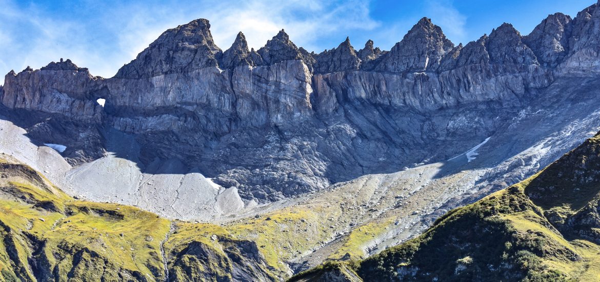
The Swiss Tectonic Arena Sardona in the north-eastern part of the country covers a mountainous area of 32,850 ha which features seven peaks that rise above 3,000 m. The area displays an exceptional example of mountain building through continental collision and features excellent geological sections through tectonic thrust, i.e. the process whereby older, deeper rocks are carried onto younger, shallower rocks. The site is distinguished by the clear three-dimensional exposure of the structures and processes that characterize this phenomenon and has been a key site for the geological sciences since the 18th century. The Glarus Alps are glaciated mountains rising dramatically above narrow river valleys and are the site of the largest post-glacial landslide in the Central Alpine region.
In order to be inscribed on the UNESCO World Heritage list, sites must be of outstanding universal value and meet at least one of the ten Criteria for Selection. Swiss Tectonic Arena Sardona, which enjoys the same award as the Grand Canyon in the USA, the Galapagos Islands in Ecuador and the Great Barrier Reef in Australia, meets
Criterion (viii) to be outstanding examples representing major stages of earth’s history, including the record of life, significant on-going geological processes in the development of landforms, or significant geomorphic or physiographic features, because
- nowhere else are the results of the processes that led to the formation of mountains as evident as they are here. For example, the “magic line” – Glarus Thrust can be identified immediately and is easily accessible;
- for more than 200 years, scientists from all over the world have been studying features that indicate mountain-building processes on this site, and their research results have revolutionized and are still revolutionizing the theories about how the Alps were formed;
- this region has a large variety of rocks, terrains and landscapes, which provide ideal habitats for various wild animals and plants and form the basis for biodiversity.
What is tectonics?
Tectonics is a specialized field in geology and concerns the process that controls the structure and properties of the Earth’s crust and its evolution through time. In particular, it describes the processes of mountain building, the growth and behavior of the strong, old cores of continents known as cratons, and the ways in which the relatively rigid plates that constitute the Earth’s outer shell interact with each other.
Within the property, there are many fabulous peaks such as Piz Segnas, Trinserhorn, Ringelspitz, Hangsackgrat, Pizol, Foostock and so on, but why is it named after Piz Sardona?
Sliced by a clear and sharp line (Glarus Thrust) on its surface, Piz Sardona is located at the center of the property, which is also the border area of the three Swiss cantons of St. Gallen, Glarus and Graubünden. Symbolically, it marks the cooperation among the Swiss federal government, the three cantons and the thirteen towns in the long-term conservation of this valuable site.
The reason why I love this site is that I can not only enjoy breathtaking views of the Swiss Alps but also gain insights into geology, in particular the formation of mountains and valleys. During the collision between the African and European continental plates, do you know how the Alps were formed and where it happened? Were the Alps created by folding or overthrust? Do you know the formation of the Alps is an ongoing process and is still happening nowadays? Why is the magic line – Glarus Thrust so important and what does it tell us about the creation of the Alps? Why are older rocks on top of younger rocks? How many different kinds of rocks can be found in the arena, where did they come from and how old are they? Do you know rockslides also contributed to the formation of the Alps and the largest rock avalanche in the Central Alps is the Flims rockslide? To find answers to most of the above questions, I propose to you three ways. The first one, which is my favorite, is to set your foot in the region and read the info panels on site while witnessing the actual miracles. The second one is to visit Visitor Center Glarnerland and Visitor Center Elm, which host permanent exhibitions related the geological history and knowledge of the property. If it’s inconvenient for you to reach the site, please click here to visit the official website of UNESCO – Sardona, which in my opinion provides a comprehensive introduction to the property and, accompanied by pictures and graphs, vivid explanations for the spectacular phenomena.
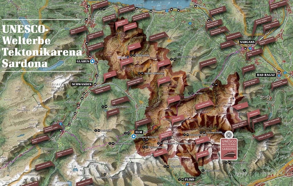
As you can see from the map above, this site covers a large area (32,850 ha) and similar to another UNESCO World Natural Heritage site in Switzerland – Swiss Alps Jungfrau-Aletsch, it can be visited and explored through numerous hiking trails and excursions. When I visited Elm, I got from the Visitor Center a brochure called “UNESCO World Heritage Tectonic Arena Sardona – Hiking and Excursion Tips”, which provides a brief introduction to the property and presents the famous Sardona World Heritage Trail, which allows hikers to walk through the core of the site and learn about geology in 6 days, 6 Geo hiking trails, 6 Geo excursions and 6 Geo phenomena, etc. As far as I know, the Heidiland holiday region, the Elm holiday region, and Flims are particularly popular among visitors. In the autumn of 2016, I hiked around Pizol, but because the peaks were almost all covered in snow, I plan to revisit the area and finally take the famous 5-lake hiking trail. In 2018, I took the Tschinglenbahn from Elm to Tschinglenalp below the famous Martinsloch (Martin’s Hole) and hiked to Firstboden and back. In this post, I’ll introduce the hiking experience in detail. In the near future, I’d love to take the “Höhenweg Naraus – Segneshütte – Alp Nagens” because I read that from several viewpoints along the way, the entire Flims Valley, the Segnesboden (the most beautiful braids of Flims) and the Glarus Thrust can be seen very clearly. However, please don’t think that you can only explore Tectonic Arena Sardona from these three regions. In the north of the site, you can see the “Riesendoline Helloch“, which had originally been a cave but collapsed later and at Skihütte Mülibachtal, you can see the Gipsgrat, a beautiful mountain range.
1. Expedition Tschinglen


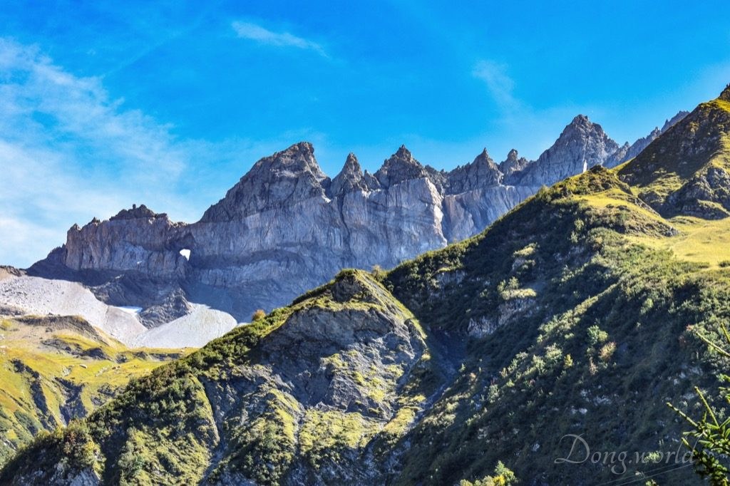
This was one of my best experiences of hiking in Switzerland because first of all, there were not many tourists and secondly, I travelled alone but never felt so. From the staff at the lower cable car staton, who tried to explain to me how the famous Glarus Thrust was formed and how the older rocks came to lay on the younger ones, to the local hikers, who greeted and chatted with me along the way introducing the surrounding mountains and valleys including of course the famous Tschingelhörner with its Martinsloch (Martin’s Hole), everyone was so kind and friendly. Compared to Jungfraujoch, Piz Gloria and First Grindelwald in Jungfrau region, which are in my opinion overdeveloped in tourism, I prefer lesser-known places such as Tschinglenalp where I can hear the nature more clearly. In this chapter, I’ll first give you some practical information and tips and then I’ll show you the hiking trail and the surroundings. On the way, there will be several info points where you can learn about geology and understand why Tectonic Arena Sardona has been inscribed by the UNESCO as a World Heritage site. which should be protected for all humanity.
1.1 Practical information
Operation hours:
- in 2018, Tschinglenbahn will be in operation from 19th May to 21st October;
- in general, from Monday to Friday, the cable car runs every hour and on Saturdays, Sundays and holidays, it runs every half an hour;
- for more accurate schedule and updated information for the next years, please click here.
Ticket prices:
- from Elm to Tschinglenalp (going up): adults: CHF 12.-, children: CHF 6.-
- from Tschinglenalp to Elm (going down): CHF 7.-, children: CHF 4.-
- round trip: CHF 18.-, children: CHF 9.-
- considering there’s no ticket office at the upper station, if you have already bought the return or downhill ticket before going up, you should show it to the staff at the lower station. If not, you can pay for the trip when arriving at the lower station with cable car.
1.2 Tips


My itinerary was: Zurich HB – [train + bus] > Elm, Station – [walk 20 mins] > Tschinglenbahn lower station – [cable car] > Tschinglenalp – [hike] > Firstboden – [hike] > Tschinglenalp – [cable car] > Tschinglenbahn lower station – [walk 25 mins] > Elm, Dorf (the Church of Elm and the visitor center of Tectonic Arena Sardona in Elm) – [bus + train] > Zurich HB.
The themed trail I took this time was called Expedition Tschinglen, which is a round tour from Tschinglenalp to Firstboden and then back to Tschinglenalp. You can extend the trail by hiking between Tschinglenbahn lower station and Tschinglenalp instead of taking the cable car but I heard from an acquaintance on the way that her journey through the gorge up wasn’t very easy and she recommended not walking downhill as certain sections of the path were rather steep. Now I’ll give you some tips based on my own experience.
- It takes around 2.5 hours to finish the themed trail – Expedition Tschinglen, but if you plan to make some stops to take a rest or do some photo shooting, adjust your plan accordingly;
- in general, it’s rather easy to walk on the trail but I remember there were two sections which required some climbing and one section which was narrow and close to a slope. Therefore, I recommend you wearing comfortable hiking boots;
- very close to the starting point of the trail is a small village and a fountain. Get enough drinking water from here because for the rest of the trail I didn’t see any more fountains;
- close to the starting point of the trail there is a restaurant called Tschinglen-Wirtschaft, where you can have some coffee and cake or a normal meal. Alternatively, in the middle of the Firstboden round trail, you will find a stone grill and a “house” storing woods. You can use them free of charge to have a picnic but don’t forget to bring a lighter, some paper and your own food;
- as long as you follow the signposts and don’t go off-trail, you won’t get lost. However, when you stand in front of the signpost “Stellihorn 1625 m ü.M.”, the Firstboden round trip starts. You should take the right path and later, you will return from the one right in front of you. From “Stellihorn 1625 m ü.M.” to Tschinglenbahn lower station, you will take the same path back;
- on the way, there will be a few info boards helping you learn about geology and history;
- if you like photography, I’m afraid you will feel a bit disappointed because the south-east wall of the famous Tschingelhörner with the evident Glarus Thrust and Martinsloch will be in the shadow most of the time. The later it gets, the more sunlight the wall gets. Therefore, if you want to achieve the best result, I recommend you shooting your photos in the late afternoon, but don’t miss the last cable car going down.
1.3 Expedition Tschinglen

Once getting off at the bus stop Elm, Station, you will see the first info board which introduces briefly the Swiss Tectonic Arena Sardona, and the Expedition Tschinglen. The property covers more than 30,000 ha and lies at the border regions of cantons St. Gallen, Glarus and Graubünden (Grisons). At few places in the world are the witnesses of mountain building such as thrusts, folds and faults so monumental and clearly visible and as a result, numerous geologists have been visiting and studying this area for more than 200 years. Their research findings revolutionized the theory of mountain building and during the hike, we will catch a glimpse of them.
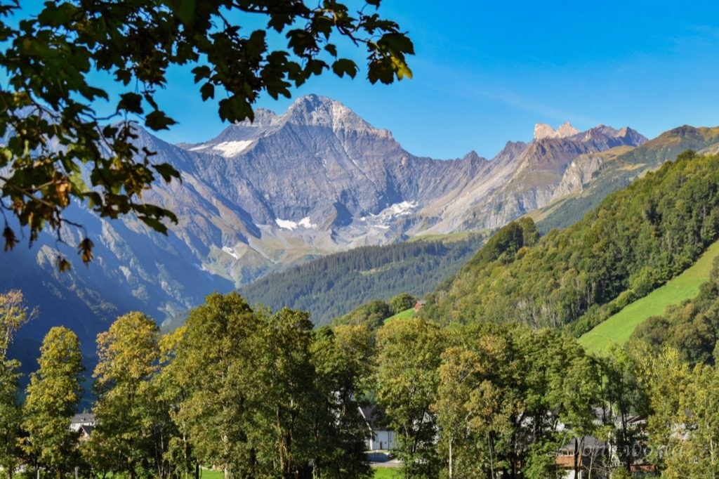
As I mentioned above, it takes around 20 mins to walk from the bus stop to the lower cable car station but the path is magical as it makes you feel the distance is shorter. I arrived early in the morning and there were no people or cars on the way, which gave the area absolute peace and quietness. Nevertheless, on 11th September 1881, the exact site was immersed in horror and loud noises of screaming, crying, slope shifting and rock falling as 10 million cubic meters of rock became loose (due to improper slate mining) and in three drops covered 90 hectors of fertile and inhabited land. 114 people and 83 buildings were buried under the debris. Dozens of men spent decades blasting large boulders, shattering rocks and removing piles of rubble, which in consequence turned a rocky desert into the beautiful agricultural and living area that we see nowadays. The story is told on an info aboard in the middle of the 20-min path and also on it you will see a painting by Heinrich Burger, which was painted two days after the disaster and shows where the rockslide happened, and a recent picture of the area, on which the red line corresponds to that on Burger’s painting. Later when we are on the expedition, we will walk through the slope where the rocks slid and dropped. Also from here, I got a good view of the Hausstock (the mountain you can see in the 2nd picture above), where the Glarus Thrust is clearly visible as the types of rock above and below have different colors and below it a large, striking fold which looks like the number “3” can be spotted. If you can’t see the fold from here, don’t worry. When we are at Firstboden, we will see both features more clearly.


A few minutes away by foot from the upper cable car station is a small village where the restaurant “Tschinglen-Wirtschaft” is located. Surprisingly, it’s still inhabited as I saw people coming out of their chalets to get water from the fountain for washing or cooking. I recommend you filling up your bottles with drinking water here as well as I didn’t see any more fountains for the rest of the expedition.


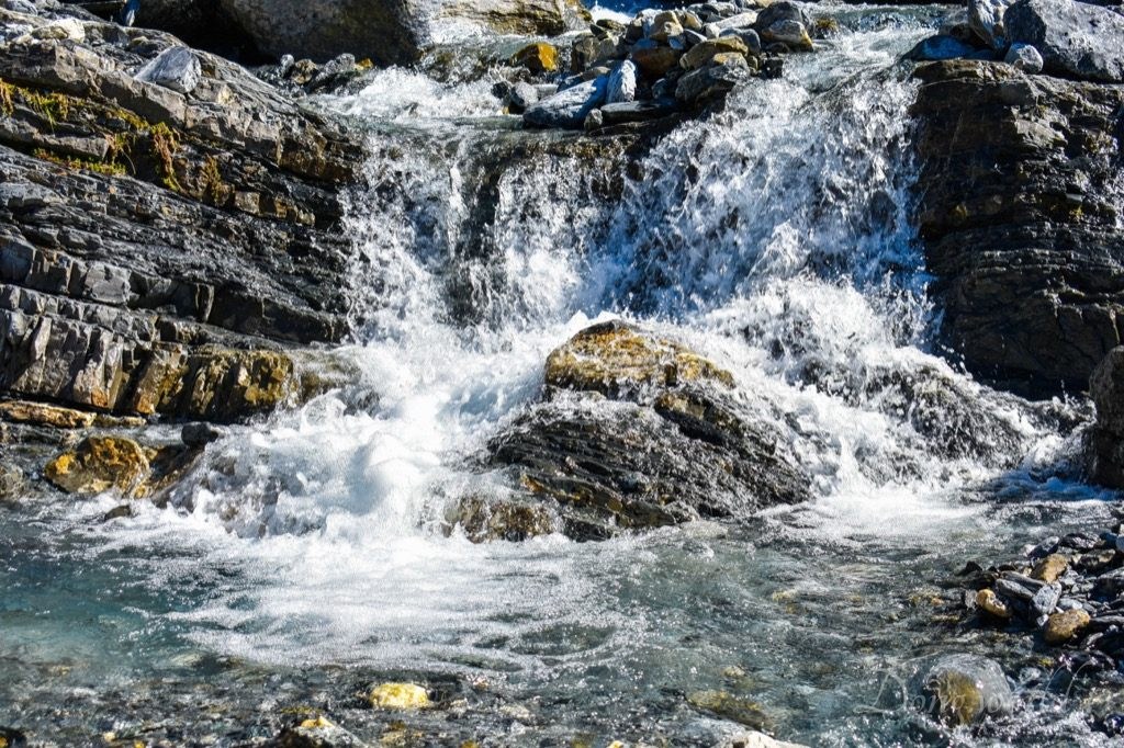
One impressive feature I noticed during my hike to Firstboden was the mountain streams with their crystal-clear blue color. If I remember correctly, I crossed two bridges on the way, both of which seemed like simple wooden boards (as you can see in the 1st picture above). Admittedly, because there were no railings and the design was rather simple, I felt a bit thrilled while crossing them, especially when they swung a bit, but I did trust their quality and passed confidently. If you want to get close to the water, it’s easy to reach certain sections of the stream bed. Not far from the stream “Mattbach”, you will find an info panel explaining “Without streams there are no mountains.” The Alps are lifted relative to the Swiss Plateau and thanks to the landscape-shaping power of glaciers, rivers and streams, mountains and valleys are formed. Do you know
- Elm, Sargans and the place where the info panel is located are rising at a speed of 1.1 mm/year relative to Zurich;
- Glarus is rising at a speed of 0.7 mm/year, Ziegelbrücke 0.5 mm/year, Chur, Bonaduz and Thusis 1.4 mm/ year relative to Zurich?
How is a high plateau formed?
When an area is lifted relative to another, without the landscape-shaping influences of glaciers, rivers and streams, a high plateau if formed.
How are mountains and valleys formed?
When a plateau is being lifted and at the same time being eroded by glaciers, rivers or streams, a mountain landscape, like the Alps, is being formed. However, the erosive force does not shape the rising area evenly. They mainly erode the less resistant surfaces, which leads to the formation of valleys, while the more resistant rocks become mountains.

Take a look at the boulder in the picture above. Can you recognize anything special about it? Before reading about it, it just looked like any other rock on the mountain. However, to geologists, it’s a priceless piece of treasure. It consists of the so-called verrucano rock, which was formed in a dry and hot desert around 250 – 300 million years ago. At that point, there were no Alps, Europe or Atlantic Ocean. During the formation of the Alps, the rock (please note here we are talking about the rock in general instead of the specific boulder) was transported around 20 km below the sea level and heated to 350 degrees. Nowadays, the rock forms part of the Alps and around Tschinglenalp, it forms the peaks of Vorab, Ofen and Tschingelhörner, which are more than 2.8 km above sea level. Now, let me introduce to you the simplified version of the epic journey of the boulder:
- 250 – 300 million years ago, the rock this boulder consists of was formed;
- more rock was deposited onto this rock, pressing it deeper and deeper;
- 30 million years ago, during mountain building, the rock was pushed even deeper;
- 20 million years ago, the rock was around 20 km below the sea level, and the rise of the Alps began;
- during the rise, the rock was lifted more than 20 km;
- the boulder tumbled roughly 1 km down into the valley, resting at its current spot;
- in the future, it will continue down the valley.
Please distinguish the verrucano rock from the boulder as the latter is just a piece of the former which fell into the valley and rests at where it is now. I believe the graph shown on the panel refers to the rock instead of the boulder.
I guess many of you are wondering how long 250 – 300 million years is and I have to say the comparison made on the info board is really interesting and easy to understand. Let’s assume time passes faster and one year is only a second. In this case, no human can live longer than two minutes; the birth of Jesus Christ just happened a bit more than half an hour ago; the peak of the last Ice Age was six and half hours ago; and the boulder was formed around nine and half years ago.

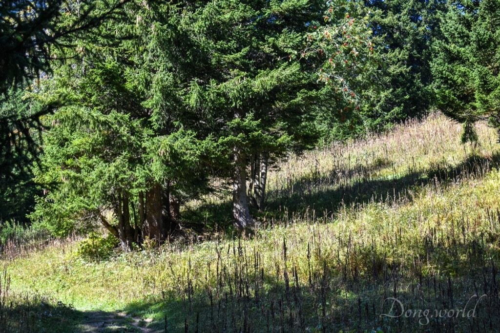

After some ascent, I arrived breathless in front of the info panel “Tschinglenalp – a wild haymaking paradise surrounded by rocks”. This section wasn’t very comfortable to walk on not only because it’s a bit steep but also because the path was uneven and certain parts were rather slippery due to the little mountain streams. However, I was surprised twice on the way. One of the times was when I saw three wild deer running right in front of me through the forest and the other time was when I spotted the famous Amanita muscaria, commonly known as the fly agaric or fly amanita (as you can see in the 1st picture above). I always thought it’s extremely poisonous as it appeared often in movies and books as the symbol of poisonous mushrooms, but I read from Wikipedia that reports of human deaths resulting from its ingestion were extremely rare. After parboiling, which weakens its toxicity and breaks down the mushroom’s psychoactive substances, it is eaten in parts of Europe, Asia, and North America.
Next to the info panel is a bench, where you can sit and take a rest. From here, you have a good view through the trees of Tschinglenalp and Tschingelhörner. The origin of the words “Tschinglen” and “Tschingel” is not clear but possibly they have their roots in the Latin word “Cingulum”, which means “belt“, in the Romansh word “tschingclar”, which means “to surround“, or in the Middle High German word “Zingel”, which means “naked rock” or “band of rock”. All in all, the Tschingelhörner do look like a belt made of rock.
- In 1703, Swiss natural scientist Johann Jakob Scheuchzer hiked from Flims through the Segnespass to Elm.
- In 1931, the first cable car from Tschinglenalp down to the valley was established but it wasn’t open for tourists or geologists but for haymakers to transport their bales.
- In 1964, a new cable car was built for the construction of High Voltage Overhead Transmission Lines.
- In 2009, the old cars were replaced with two four-people gondolas, and since then, tourists as well as geologists have been able to travel from Elm to Tschinglenalp conveniently.
In 1835, the Community of Elm bought Tschinglenalp and has been using it as a haymaking alp from then on. Even nowadays, it’s used for hay production and sheep grazing. In the pictures on the info panel, you can glance at the life of haymakers in the old days, such as their break and how they transported the bales with cable car.

After a leisurely walk, I arrived in front of another info panel which is about “Slate rock water for Elmer Citro”. Do you know “Elmer Citro“? Created in 1927 by Oskar Schärli, it’s the best-known Swiss lemonade and is based on virtually nitrate-free mineral water from the springs of “Gstögg” and “MW3”. Do you remember I mentioned before that on 11th September 1881, 10 million cubic meters of rock became loose due to improper slate mining and fell, burying 114 people and 83 buildings? After the horrible disaster, the Community of Elm consulted the famous Alp-geologist Albert Heim to see if there’s any chance to continue mining slate but in a safe manner. In the autumn of 1881, Mr. Heim demonstrated in a graph how good slate could be mined safely with tunnels. When no slate worthy of being mined remained in 1927, the operation was shut down and the tunnels were left to decay. Coincidentally, it was the same year that Oskar Schärli created “Elmer Citro”, first using the mineral water from the springs close to Elm and nowadays using the water dripping from the rock in the deserted tunnels. In one of the pictures on the info panel, you can see mineral water of prime quality leaking from the walls of an old tunnel and that section is called the “Gstögg Spring”, which is located around 250 m below the mountain surface. The water is collected and directed to the bottling plant of Elmer Citro.
Also on this panel you can see a map, on which one section is shadowed in pink. That’s the protection zone of the mineral water of Elmer Citro. Part of the water that seeps away in this zone reappears several years later as mineral water inside the mountain and is used for Elmer Citro. Therefore, contamination must be prevented, which means that in this area sheep and cattle are not allowed to graze, chemical fertilizer or dung can not be used and the disposal or deposit of waste is prohibited. The location of the springs, “Gstögg” and “MW3”, which provide the water for Elmer Citro today, are also marked on the map. It’s a pity that though I’ve been living in Switzerland for more than three years I haven’t tried the famous lemonade yet. I’ll make sure to get a bottle from Migros as soon as possible. If you love the drink, why not taking the “Elmer Citro Spring Hiking Path“, on which five info panels will tell you about its history. During the journey, you will discover almost all the active and inactive springs of Elmer Citro. As a welcome and reward, shortly before reaching the end of the trail, you will see the “Elmer Citro Fountain“, which is filled with Elmer Citro bottles daily in the summer. The path starts and ends at the playground at the edge of the village of Elm and takes around 1.5 hours to finish.


This section was the scariest of the entire hiking trail and I’m not sure whether it was because the path was very narrow and the slope seemed steep and endless or because I was shocked and frightened by the catastrophe which killed 114 people and destroyed 83 buildings. It was right below this info panel that 10 million cubic meters of rock broke and spread around 2 km into the valley in an enormous stream of rocky debris on 11th September 1881. In the pictures on the info panel, you can see which part of the present valley was buried, where we are standing now and where the loose rocks came from. Can you imagine? The stream of rubble destroyed 90 hectares of fertile and inhabited land, which is roughly the size of 120 football fields.


After another rather steep ascent, I arrived at the highest point of the expedition – Firstboden, which is 1750 m above sea level. From here, I had an amazing view of the valley and surrounding mountains. This is a great place for taking a rest because if you don’t like the sun, you can hide under the wooden roof (as you can see in the 1st picture above) like I did and if you want to get tanned, you can sit on the bench around a large table. Surprisingly, when I was there, I was the only one sitting in the shadow. What a clear difference in preference between most of the Chinese and Europeans. When I was having some snacks, I noticed an old man bringing out a few bags of sausage, some bread, a glass and a small bottle of wine. It turns out you can use the wood under the wooden “pavilion” (free of charge) and the semi-circular stone grill to make a barbecue. He looked very professional as he brought matches, pieces of newspaper and a Swiss army knife to cut the large wood blocks into small pieces. If I had known there was a place like this on the trail, I would probably have made some preparations because what the man did looked really fun.
If you feel a 2.5 h hike is not enough, you can continue to walk up (as you can see in the 2nd picture above). I’m not sure how high you can reach but I climbed for around 10 mins and didn’t see much difference scenery-wise so I returned. As I mentioned when I was on the way to the lower cable car station, from here, you can see clearly the Hausstock (the mountain you can see in the 3rd picture above), in particular on its wall the Glarus Thrust and the striking fold (a bend or curvature of strata) which looks like the number “3”. I was wondering why there was no info panel on Firstboden considering it was a great place for admiring the Tschingelhörner. It turned out there’s an even better place. Please walk towards Martinsloch and soon you will see a small path leading to the next info panel.


From here, you have a fantastic view of two monumental geological features, one of which is the Glarus Thrust, a landmark of the formation of the Alps, while the other one is Martinsloch (Martin’s Hole), an evidence of their decay. To he honest, the hole looks like a heart to me but why isn’t it called Martinsherz (Martin’s Heart) which sounds more romantic? Over millions of years, a large variety of rocks was deposited in valleys, seas and lakes on earth’s surface and in most cases, younger lie atop old rocks. However, here in Swiss Tectonic Arena Sardona, the rock layers are upside down, which means older rocks lie atop younger ones. In order to explain this phenomenon, we have to take a close look at the Glarus Thrust, which is where the Verrucano rock (formed 250 – 300 million years ago) was pushed upon the Flysch rock (formed 35 – 50 millions years ago) during the formation of the Alps. In the picture on the info panel, the red line marks the Glarus Thrust, the dark red shadow marks the Verrucano rock and the yellow shadow marks the Flysch rock. What about the grey shadow in between? It marks the intermediary rock called Lochseiten calc-tectonite, which might have functioned as lubricant during the movement of those two different kinds of rocks. Compared to the thrust, which extends from Flims to Schwanden and to Sargans and was active 10 – 25 million years ago, Martin’s hole, whose formation began a few thousand years ago, is much smaller and younger. Even so, its widest part is 18 meters, which is still considerably wider than a two-lane tunnel.


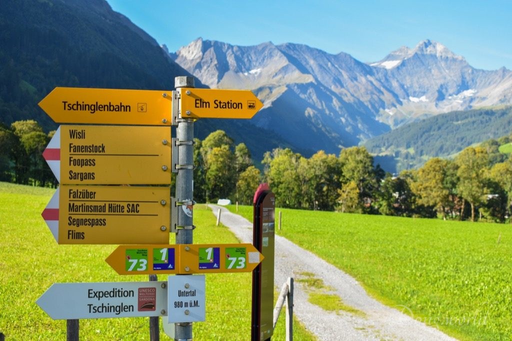
Now it’s time to go back to the upper cable car station. Please note, from Stellihorn (as you can see in the 1st picture above) to Firstboden and back to Stellihorn, it’s a round trip but there’s only one path between the upper cable car station and Stellihorn, which means you need to take the same trail back. When I arrived at the Stellihorn signpost, I followed the sign “Expedition Tschinglen”, but after a few minutes, I realized I had taken the route before. It turned out I was on the Firstboden round trip again. When you are here, please remember not to repeat my mistake.
If you feel a bit tired after the hike, maybe it’s time to have a cup of coffee and some dessert in the restaurant “Tschinglen-Wirtschaft”. From here, you can choose to walk a few minutes up to take the cable car to go to the valley station or hike down through the Tschinglenschlucht, which is part of the Expedition Tschinglen. I learnt from a hiker on the way that it might be a better idea to hike up instead of hiking down because several sections were rather steep. Anyway, if you decide to embark on the adventure, you might be lucky enough to find a fossil, many of which were discovered by workers mining slate in the mountain. The gorge seems rather inhospitable nowadays but millions of years ago it was full of life, which can be testified by the large variety of fossils found here. I took the cable car both up and down and though I wasn’t as close to the gorge as those hikers, I admired it from above and was no less impressed and fascinated by its magnificent cliffs and roaring water.
2. Tectonic Arena Sardona Visitor Center Elm

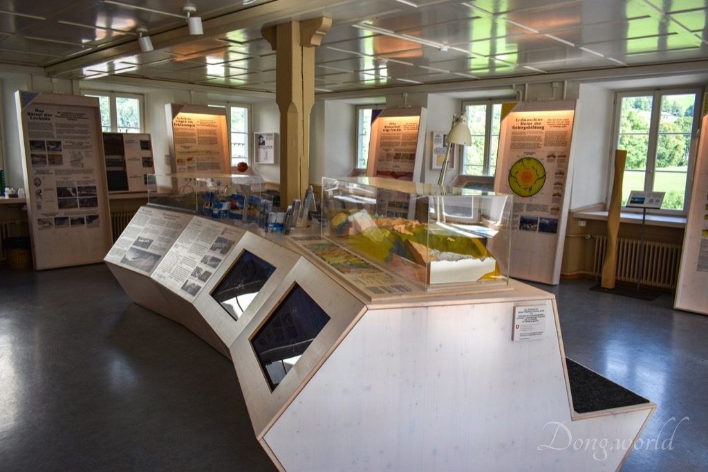

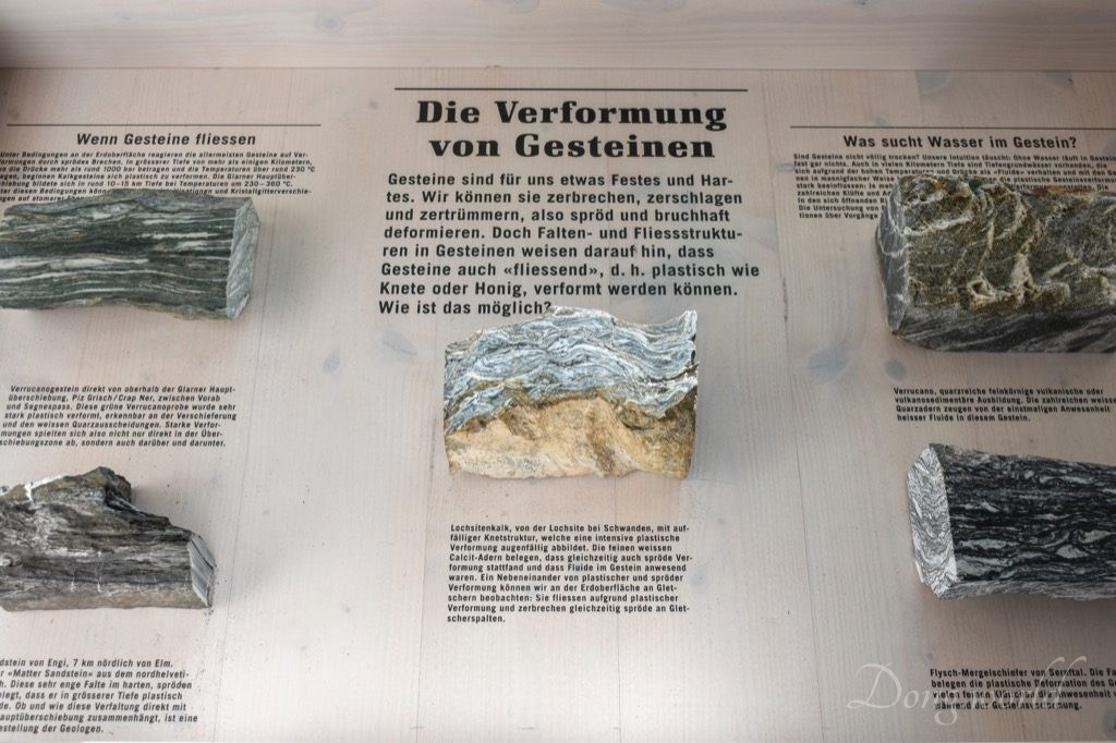
After going back to the bus stop “Elm, Station” from the lower cable car station, I recommend you walking for another 5 minutes to reach the bus stop “Elm, Dorf”, where the Tectonic Arena Sardona Visitor Center, Elm is located. It’s open daily from 10:00 to 20:00 and can be visited free of charge. Unfortunately, most of the information is only available in German and I only found a few brochures and flyers in English. Although I can speak a bit German, the terms used in geology are too special and it was basically impossible for me to understand. If you are interested in geology and speak German very well, I think you’ll find it worth your time.
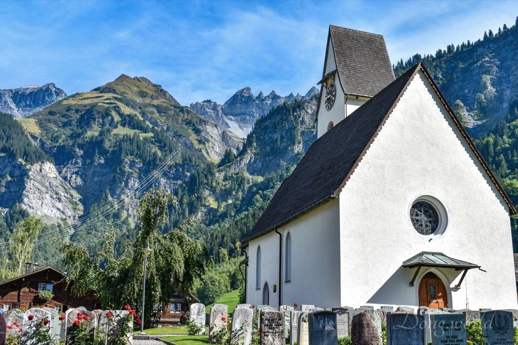
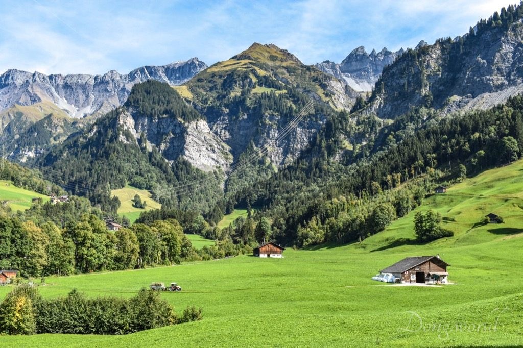

What actually interested me here were two info panels explaining the formation of Martinsloch (Martin’s Hole) and Martinsrössli (Martin’s Small Horse). At an altitude of 2,600 meters above sea level in the magnificent Tschingelhörner, Martinsloch is perhaps the most famous rock opening in the UNESCO World Heritage Site Tectonic Arena Sardona, which became famous due to a unique event. Each year, on 12th and 13th March and 30th September and 1st October, the sun bursts through the opening and shines directly on the tower of the Church of Elm. The magical show lasts just a few minutes but has been attracting numerous spectators from all over the world. On the info panel about Martinsloch, you can see a slide showing how the hole shines beautifully when it’s flooded with sunlight.
Concerning the formation of the hole, there are many legends, but the most famous one is about the shepherd Martin, who took care of his animals on the Elm side of the mountain. One day, a giant from Flims attacked his flock and tried to steal some of his sheep. Martin defended his animals and the giant fled. Martin hurled his staff after the giant, but it missed the giant and struck the Tschingelhörner, causing a vast sea of rocks crashing down the valley. Once peace was restored, a triangular-shaped hole was visible in the rock face, which was then called the Martinsloch. A legend is after all a legend. From a geoscientific point of view, the initial cause of the hole was the formation of the Alps. During that period of time, the rock which once filled the hole was much affected by movement, in which large masses of rock were pushed, deformed, broken apart and ground up. When uplift and erosion brought the masses of rock to the surface, the ground-up rock in the area which was to become Martinsloch fell into the valley faster than the surrounding rock, causing the formation of cave-like recesses on both sides of the mountain ridge. As time went by, the recesses became deeper and deeper and finally met each other forming a hole. Since then, it’s been growing constantly. Nowadays, its widest part is 18 meters, only 5 meters shorter than the tower of the Church of Elm. As I learnt from the hikers on the way, with a guide and special equipments, it’s possible to hike up to Martinsloch either from Elm or Flims. What an unforgettable adventure it would be! Unfortunately, I’m quite certain I’m not ready for that yet.

Close to the church and visitor center, you will find another piece of art created by the greatest artist of all time – nature. Martinsrössli (Martin’s Small Horse), which looks like having the head of a horse, has a rich history. Its red rock is almost 300 million years old and was formed not far from the equator in a desert with many volcanoes. Hidden deep underground, it traveled north together with the continents. During the formation of the Alps, it was lifted to the surface, and then the work of the Sernf River began. With water carrying gravel and sand, the river created this artful shape. For hundreds of years, the artwork rested in the riverbed of Sernf and in 2014, it was brought to the center of Elm, where it was solemnly christened as “Martinsrössli” – Martin’s Small Horse.
As I mentioned at the beginning of the post, Swiss Tectonic Area Sardona covers an entire space of 32,850 ha and can be explored by numerous hikes and excursions. In this post, I focused on one of the most amazing features of the property, that is to say, Tschingelhörner with its clearly visible Glarus Thrust and Martinsloch. In addition, I also introduced the history of Elm and Tschinglenalp, and explained some geological phenomena which are related to the formation of the Alps. In the future, I’ll keep discovering new, interesting and impressive hiking trails and destinations in and around the property, and I’ll make sure to keep you updated. To be continued…
