This is part of a series of posts dedicated to the exploration of Swiss Tectonic Arena Sardona, a UNESCO World Heritage site covering an entire area of 32,850 ha. The next few paragraphs will be about the site’s universal value (the reason why it is inscribed on the World Heritage list) and a brief introduction to various hiking trails and excursions recommended by IG Tektonikarena Sardona. If you have already read some other posts related to the property, please click here to jump directly to the main content of this one.
As the UNESCO comments:
The Swiss Tectonic Arena Sardona in the north-eastern part of the country covers a mountainous area of 32,850 ha which features seven peaks that rise above 3,000 m. The area displays an exceptional example of mountain building through continental collision and features excellent geological sections through tectonic thrust, i.e. the process whereby older, deeper rocks are carried onto younger, shallower rocks. The site is distinguished by the clear three-dimensional exposure of the structures and processes that characterize this phenomenon and has been a key site for the geological sciences since the 18th century. The Glarus Alps are glaciated mountains rising dramatically above narrow river valleys and are the site of the largest post-glacial landslide in the Central Alpine region.
In order to be inscribed on the UNESCO World Heritage list, sites must be of outstanding universal value and meet at least one of the ten Criteria for Selection. Swiss Tectonic Arena Sardona, which enjoys the same award as the Grand Canyon in the USA, the Galapagos Islands in Ecuador and the Great Barrier Reef in Australia, meets
Criterion (viii) to be outstanding examples representing major stages of earth’s history, including the record of life, significant on-going geological processes in the development of landforms, or significant geomorphic or physiographic features, because
- nowhere else are the results of the processes that led to the formation of mountains as evident as they are here. For example, the “magic line” – Glarus Thrust can be identified immediately and is easily accessible;
- for more than 200 years, scientists from all over the world have been studying features that indicate mountain-building processes on this site, and their research results have revolutionized and are still revolutionizing the theories about how the Alps were formed;
- this region has a large variety of rocks, terrains and landscapes, which provide ideal habitats for various wild animals and plants and form the basis for biodiversity.
What is tectonics?
Tectonics is a specialized field in geology and concerns the process that controls the structure and properties of the Earth’s crust and its evolution through time. In particular, it describes the processes of mountain building, the growth and behavior of the strong, old cores of continents known as cratons, and the ways in which the relatively rigid plates that constitute the Earth’s outer shell interact with each other.
Within the property, there are many fabulous peaks such as Piz Segnas, Trinserhorn, Ringelspitz, Hangsackgrat, Pizol, Foostock and so on, but why is it named after Piz Sardona?
Sliced by a clear and sharp line (Glarus Thrust) on its surface, Piz Sardona is located at the center of the property, which is also the border area of the three Swiss cantons of St. Gallen, Glarus and Graubünden. Symbolically, it marks the cooperation among the Swiss federal government, the three cantons and the thirteen towns in the long-term conservation of this valuable site.
The reason why I love this site is that I can not only enjoy breathtaking views of the Swiss Alps but also gain insights into geology, in particular the formation of mountains and valleys. During the collision between the African and European continental plates, do you know how the Alps were formed and where it happened? Were the Alps created by folding or overthrust? Do you know the formation of the Alps is an ongoing process and is still happening nowadays? Why is the magic line – Glarus Thrust so important and what does it tell us about the creation of the Alps? Why are older rocks on top of younger rocks? How many different kinds of rocks can be found in the arena, where did they come from and how old are they? Do you know rockslides also contributed to the formation of the Alps and the largest rock avalanche in the Central Alps is the Flims rockslide? To find answers to most of the above questions, I propose to you three ways. The first one, which is my favorite, is to set your foot in the region and read the info panels on site while witnessing the actual miracles. The second one is to visit Visitor Center Glarnerland and Visitor Center Elm, which host permanent exhibitions related the geological history and knowledge of the property. If it’s inconvenient for you to reach the site, please click here to visit the official website of UNESCO – Sardona, which in my opinion provides a comprehensive introduction to the property and, accompanied by pictures and graphs, vivid explanations for the spectacular phenomena.
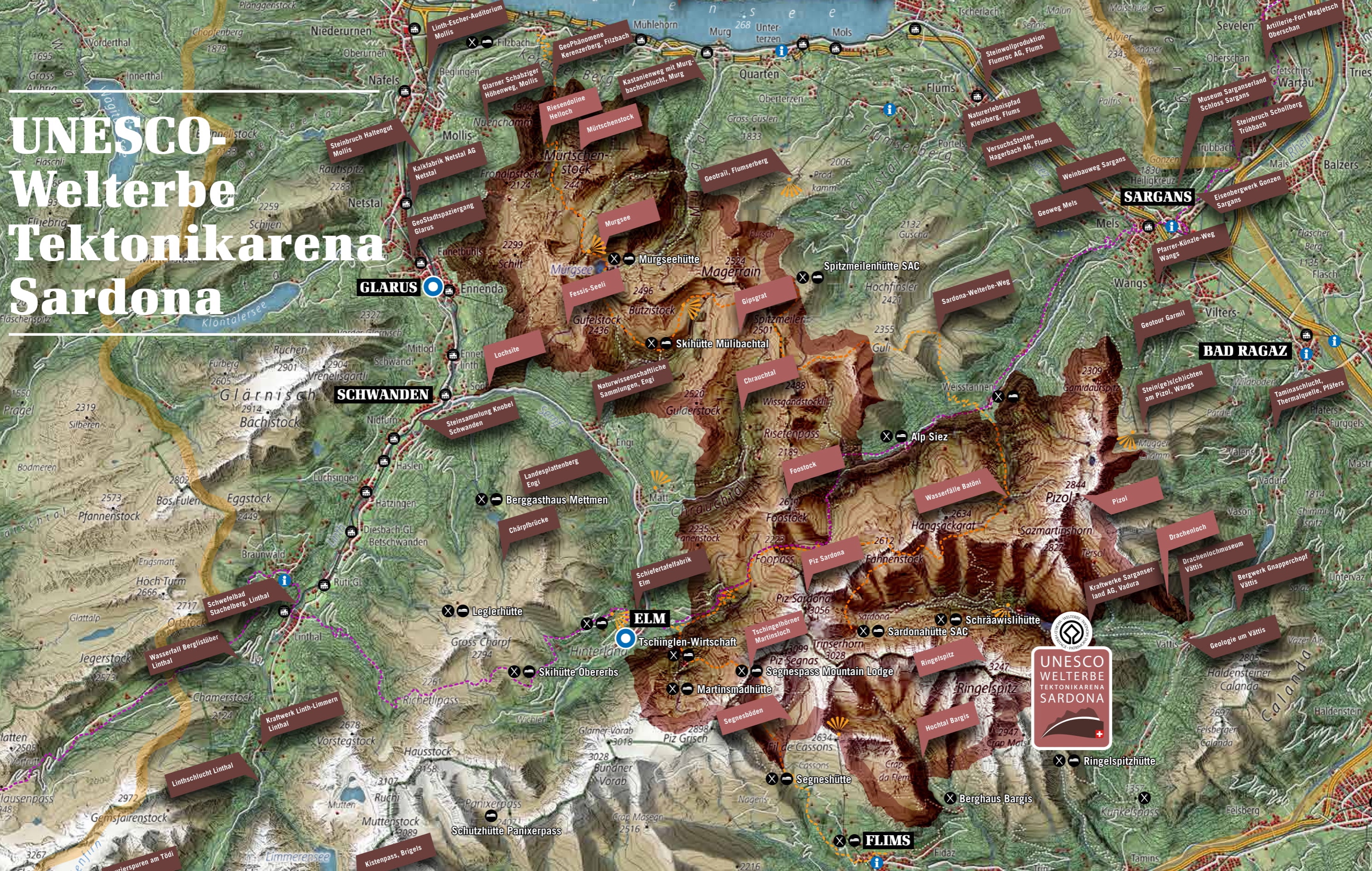
As you can see from the map above, this site covers a large area (32,850 ha) and similar to another UNESCO World Natural Heritage site in Switzerland – Swiss Alps Jungfrau-Aletsch, it can be visited and explored through numerous hiking trails and excursions. When I visited Elm, I got from the Visitor Center a brochure called “UNESCO World Heritage Tectonic Arena Sardona – Hiking and Excursion Tips”, which provides a brief introduction to the property and presents the famous Sardona World Heritage Trail, which allows hikers to walk through the core of the site and learn about geology in 6 days, 6 Geo hiking trails, 6 Geo excursions and 6 Geo phenomena, etc. As far as I know, the Heidiland holiday region, the Elm holiday region, and Flims are particularly popular among visitors. In the autumn of 2016, I hiked around Pizol, but because the peaks were almost all covered in snow, I plan to revisit the area and finally take the famous 5-lake hiking trail. In 2018, I took the Tschinglenbahn from Elm to Tschinglenalp below the famous Martinsloch (Martin’s Hole) and hiked to Firstboden and back. In this post, I’ll introduce the “Höhenweg Naraus – Segneshütte – Alp Nagens” in detail because from several viewpoints along the way, the entire Flims Valley, the Segnesboden (the most beautiful braids of Flims) and the Glarus Thrust can be seen very clearly. Please don’t think that you can only explore Tectonic Arena Sardona from these three regions. In the north of the site, you can see the “Riesendoline Helloch“, which had originally been a cave but collapsed later, and at Skihütte Mülibachtal, you can see the Gipsgrat, a beautiful mountain range.
1. Hiking Trail Naraus – Segneshütte – Alp Nagens


After hiking below the Elm side of the Tschingelhörner, I couldn’t wait to hike below the Flims side because as I mentioned in the other post, the lighting should be better on the latter and according to my experience, it really was. Nevertheless, what disappointed me a bit was that the famous Martinsloch (Martin’s Hole) wasn’t really visible due to distance and angles. Therefore, if you are particularly fascinated by the Martinsloch, I recommend you taking the Expedition Tschinglen and admiring it either at Tschinglenalp or Firstboden or in front of the Church of Elm. If you are an experienced hiker, with an official guide, it’s even possible to pass the Segnespass connecting the towns of Elm and Flims. It’s certainly a challenging pass but trust me, in no other ways can you get closer to Tschingelhörner and Martinsloch. In this chapter, I’ll first give you some practical information and tips and then I’ll show you the hiking trail I took.
1.1 Practical information
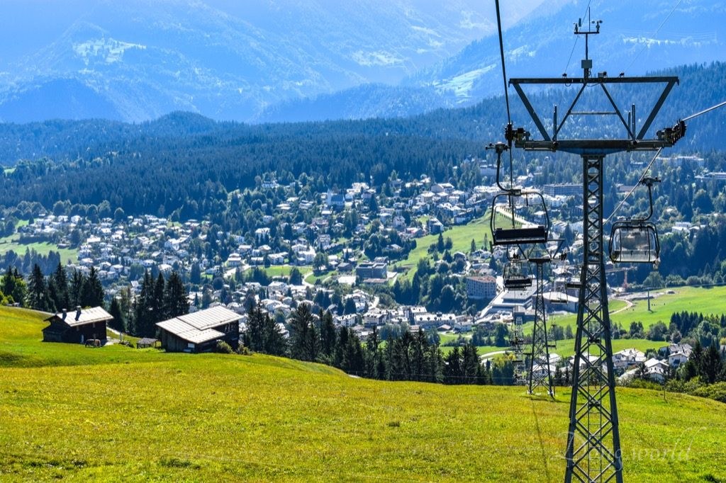
In the Flims Ferienregion (Flims Holiday Region), there are many cables cars and chairlifts taking you to various mountain stations but the ones I used during the specific hike were chairlifts from Flims Dorf, Bergbahnen to Naraus and bus from Alp Nagens to Laax GR, Bergbahnen.
Operation hours and ticket prices:
This hiking trail can only be taken in the summer season and in 2018, the chairlift Naraus is open from 3oth June to 21st October.
Combined ticket Nagens – Naraus is available for hikers and costs:
- Adults (from 18 years old) CHF 30.- (with Flims Ferienregion Guest Card CHF 25.-)
- Youths (13 to 17 years old) CHF 20.- (with Flims Ferienregion Guest Card CHF 17.-)
- Children (6 to 12 years old) CHF 10.- (with Flims Ferienregion Guest Card CHF 8.-)
Please note:
- if you want to know about the schedule of Chairlift Naraus or Nagens Shuttle Bus in the upcoming years, please click here;
- the combined ticket Nagens – Naraus can be purchased at Flims, Laax and Falera ticket offices, Flims, Laax and Falera visitor venters and on the Nagens Shuttle Bus;
- the Nagens Shuttle Bus charges special fare and GA travelcard is not valid for the ride;
- if you want to know about the individual fares for various cables cars, chairlifts and shuttle buses in this region, please click here;
- seniors over 64 years old receive a 10% discount on the adult prices (except for combined tickets or various passes);
- GA travelcard or half-price card (Halb-tax) do not give you any discounts for cable cars, chairlifts or special shuttle buses in this region;
1.2 Tips


My itinerary was: Zurich HB – [train + bus] > Flims Dorf, Bergbahnen – [2 chairlifts] > Naraus – [hike] > Segneshütte – [hike] > Alp Nagens – [bus] > Laax GR, Bergbahnen – [bus] > Flims Waldhaus, Caumasee – [walk + funicular train] > Caumasee – [funicular train + walk + bus + train] > Zurich HB.
- The total distance of the hike is 5.82 km and it takes around 2 hours to finish. I suggest you leave some more time because on the way, it’s nice to take some detours such as a walk on the Lower Segnesboden to the waterfalls and a hike to Grauberg;
- the ascent is 275 m and descent is 139 m. Though it is written on flims.com that the difficulty level of the hike is hard, I personally feel it’s between easy and medium;
- proper hiking boots are a must because though there’s no dramatic ascent or descent, certain sections are rather slippery due to rubble. In addition, a few parts are narrow and close to rather steep slopes, so be careful when you walk on them;
- there are three restaurants on the way, which are located at Naraus, Segneshütte and Alp Nagens;
- take enough water with you because I didn’t see any fountains on the way;
- remember to dress properly because I changed from thin winter jacket to t-shirt and long pants to shorts. Though the temperature wasn’t high (28th Sep, 2018), direct sunlight plus the exercise still made me sweaty;
- if you plan to hike on a sunny day, sun screen is a must;
- do not miss the last shuttle bus from Alp Nagens to Laax, which leaves from 30th June to 21st October, 2018 at 17:00;
- IMPORTANT! the shuttle bus leaves from Alp Nagens not from Nagens;
- next to the Segneshütte mountain lodge, there is a visitor pavilion providing elaborate information on the UNESCO World Heritage site Sardona. Unfortunately, the information is only available in German. In 2018, it’s open from June to October and on Sundays, an expert will be present answering all your questions.
1.3 From Naraus – Segneshütte – Alp Nagens


In order to reach Naraus, the easiest way is to take the chairlift from Flims, and on the way, I had a great view over the town and valley. Previously, it was possible to take a cable car to reach Fil de Cassons, which was a perfect spot to admire the amazing Piz Dolf, Tschingelhörner and upper Segnesboden. The high plateau, together with the lower Segnesboden, is in fact forefields of the glacier and watering places, marked by continuously changing watercourses, numerous small lakes as well as different swamp formations. Unfortunately, the transfer between Narau and Fil de Cassons was cancelled a few years ago and now, the only way to reach the Cassonsgrat Ridge is by hiking. As far as I know, the difficulty level of the hike is between medium and difficult and it takes around 2.5 – 3 hours to finish. If you are fit and want to have a complete experience of exploring the Swiss Tectonic Arena Sardona, I suggest you contact the tourism office of Flims Ferienregion (asking how long it takes and how difficult it is to hike from Naraus to Fil de Cassons and to Alp Nagens) in advance and plan your adventure. I do hope that in the future the cable car connecting Narau and Fil de Cassons will operate again and I’ll certainly pay another visit to this amazing area.
Before starting the hike, on the terrace of Restaurant Naraus, you can see a board introducing the mountain peaks which can be seen from here. For example, some of them are Piz Ela (3339 m), Corn da Tinizong (3173 m), Piz Mitgel (3159 m), Piz Laviner (3137 m), Piz Bever (3230 m), Piz Palü Hauptgipfel (3900 m), Piz Jenatsch (3250 m), Piz Greina (3124 m), Piz Vial (3168 m), and Piz Medel (3210 m). Another board you can see close to the restaurant is the summer hiking map of Flims Ferienregion. By looking at it, I just felt sad because it made me realize if I could reach Fil de Cassons, I could see clearly Ofen, Tschingelhörner with Martinsloch, Piz Segnas, Piz Sardona, Segnesgletscher, Piz Dolf, Piz Sax, Piz da Steris, and Ringelspitz, which constitute a large and the most famous part of the World Heritage site Sardona.


As you can see in the 1st picture above, there are three routes at the starting point. Unfortunately, the one we are going to take is the right one, which starts with some ascent. After some rather tiring climb, the path becomes flat, but still be careful because some sections are narrow and a bit slippery. When you reach the rocky area as you can see in the last picture above, you are close to the famous lower Segnesboden. On the way, I had a great view of Flims Valley and the surrounding mountains including Laaxer Stöckli (2898 m) and Ofen (2818 m).


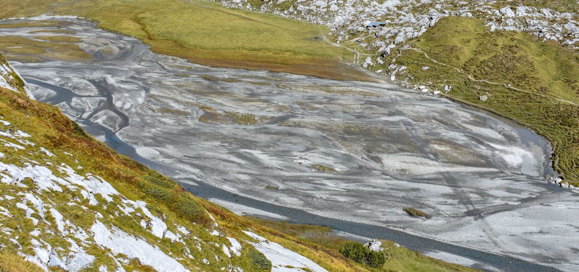
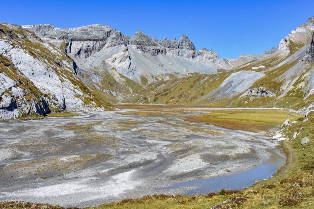
After passing through a rocky area, I finally reached the World Heritage site Sardona. Before continuing the hike to Segneshütte, I strongly recommend you walking on the lower Segnesboden and paying a visit to the waterfalls, which are only 5 mins away.

“Boden” means “floor, ground” in English and “Segnes” refers to the peak – Piz Segnas, which towers next to the plain. The lower Segnesboden is one of the several imposing alluvial planes in the World Heritage site, which was formed when streams from the surrounding mountains carried eroded materials to the valley. As I read from flims.com, each time visitors visit the upper and lower Segnesboden, they will experience something different because the streams on the two elevated plains are constantly changing their course, so the moor, which makes up around half of the alluvial soil, keeps forming new patterns, with new lakes continually forming and disappearing. In 1996, this cauldron-shaped alluvial plain, known as the lower Segnesboden, was recognised as a landmark of particular beauty and importance in the Federal Inventory of Alluvial Zones.


After walking along the lower Segnesboden, I arrived in front of the waterfalls. Admittedly, if you don’t go higher, you can’t really realize the beautiful collaboration between the mountain streams and alluvial soil. Don’t worry, later I’ll recommend you a nice spot to admire it. On the way, I noticed that the upper mountain streams not only jumped to the lower plain but also climbed down on the surface of rocks. As I read from the info board which stood at the entrance to the plain, the Swiss geologist Albert Heim was very interested in diverse natural phenomena and around 1870, he, together with some musicians curiously explored and tried to tell whether there were certain notes to be heard in the roar of the waterfalls. His findings are “After listening for a while, we always heard a C-major triad emerging very clearly, which is dulled by a low F that does not belong to the chord, which was normally heard as a low fifth of the C.” He further added “The F is a deep, muffled, humming sound that sounds as if it were far away. The larger the falling mass of water, the stronger the F.” It was surprising for me that the falling of water could become music but who knows what nature is capable of? I never studied music so I couldn’t really tell if there was a C-major triad or low F but I guess it would be interesting for someone who understands it.


After admiring and listening to the waterfalls, I decided to turn back and continue the hike to Segneshütte. On the way, the change of landscape as well as the crystal-clear, blue streams kept my eyes and camera occupied, but the protagonist was, undoubtedly, the Tschingelhörner with its Martinsloch. Why does the Tschingelhörner stand out in the World Heritage site Sardona? It’s mainly because of the two monumental geological features demonstrated on it, that is to say, the Glarus Thrust, a landmark of the formation of the Alps, and the Martinsloch (Martin’s Hole), an evidence of their decay. Over millions of years, a large variety of rocks was deposited in valleys, seas and lakes on earth’s surface and in most cases, younger lie atop old rocks. However, here in Swiss Tectonic Arena Sardona, the rock layers are upside down, which means older rocks lie atop younger ones. In order to explain this phenomenon, we have to take a close look at the Glarus Thrust (the line which divides the rocks of light and dark colors as you can see in the 2nd picture above), which is where the Verrucano rock (formed 250 – 300 million years ago) was pushed upon the Flysch rock (formed 35 – 50 millions years ago) during the formation of the Alps.
Compared to the thrust, which extends from Flims to Schwanden and to Sargans and was active 10 – 25 million years ago, Martin’s Hole, whose formation began a few thousand years ago, is much smaller and younger. Even so, its widest part is 18 meters, which is still considerably wider than a two-lane tunnel. Unfortunately, from the lower Segnesboden and Segneshütte, you don’t get a good view of it as from the Elm side. At an altitude of 2,600 meters above sea level, it is perhaps the most famous rock opening in the World Heritage site, which became famous due to a unique event. Each year, on 12th and 13th March and 30th September and 1st October, the sun bursts through the opening and shines directly on the tower of the Church of Elm. The magical show lasts just a few minutes but has been attracting numerous spectators from all over the world. On the info panel close to the church, you can see a slide showing how the hole shines beautifully when it’s flooded with sunlight. Concerning the formation of the hole, there are many legends, but the most famous one is about the shepherd Martin, who took care of his animals on the Elm side of the mountain. One day, a giant from Flims attacked his flock and tried to steal some of his sheep. Martin defended his animals and the giant fled. Martin hurled his staff after the giant, but it missed the giant and struck the Tschingelhörner, causing a vast sea of rocks crashing down the valley. Once peace was restored, a triangular-shaped hole was visible in the rock face, which was then called the Martinsloch. A legend is after all a legend. From a geoscientific point of view, the initial cause of the hole was the formation of the Alps. During that period of time, the rock which once filled the hole was much affected by movement, in which large masses of rock were pushed, deformed, broken apart and ground up. When uplift and erosion brought the masses of rock to the surface, the ground-up rock in the area which was to become Martinsloch fell into the valley faster than the surrounding rock, causing the formation of cave-like recesses on both sides of the mountain ridge. As time went by, the recesses became deeper and deeper and finally met each other forming a hole. Since then, it’s been growing constantly.


Close to the Segneshütte mountain lodge, where you can have a coffee break or a normal lunch, there is a visitor pavilion dedicated to the UNESCO World Heritage site Swiss Tectonic Arena Sardona. It is open from June to October in 2018 and every Sunday, an expert will be present answering all your questions. Unfortunately, all the information was only in German and though I have reached B2 level, it was difficult for me to understand the special terms.


Between the mountain lodge and visitor pavilion, an info board is erected introducing the by far biggest rockslide of the Alps. Around 9400 to 9500 years ago, 7 to 8 cubic kilometers of rock broke loose to the west and south of the Flimserstein and fell into the valley. From the place you stand, you have a great view of the area where it happened. The falling mass of rock spread an area of 65 square kilometers and in 15 mins, a 15 km-long part of the Vorderrhein Valley was reshaped. The Vorderrhein River was dammed and a large lake, which was about 30 km long, was formed in the area of Ilanz. When the dam became leaky, half of the built-up water broke out in a relatively short time, causing a severe flood in the Rhine Valley from Reichenau to lake Constance. From the illustration on the info board, you can get a better idea of where you stand now, where the rock broke loose, where the mass was deposited and where the dammed lake was formed in the Ilanz area.


If you want to have a good view of the lower Segnesboden, I recommend you taking a short detour and hiking from Segneshütte to Grauberg cable car station. The direction is clearly shown on the signpost nearby and though the ascent is a bit steep, it is manageable with normal hiking boots. I hiked for only 10 mins and didn’t actually reach the station, but as you can see from the pictures above, I did get a great view of the lower Segnesboden with the most beautiful braids of Flims and the magnificent Piz Atlas with its clearly visible Glarus Thrust. What’s more, I even caught a glimpse of Piz Sardona (as you can see in the 3rd picture above), after which the entire World Heritage site is named.


After Segneshütte, let’s continue our journey to Alp Nagens, where the shuttle bus to Laax departs. At Segneshütte, please walk in the direction of “Nagens Laax Panoramaweg” as indicated on the signpost and on the way, you should see another signpost (as you can see in the 2nd picture above). This time, walk in the direction of “Laax Alp Nagens” and NOT in the direction of “Nagens”. Originally I thought Berghaus Nagens (as you can see in the 3rd picture above) was where the shuttle bus stopped but when I climbed up, I realized I was mistaken. Unless you want to do more exercise, I don’t recommend walking up as the view from there wasn’t much better than that from Alp Nagens. However, I heard from an acquaintance on the way that in the winter season, Nagens with its cable car station and restaurant is a popular destination for skiers.


Without repeating my mistake, you should arrive in Alp Nagens from Segneshütte in about half an hour. On the way, the magnificent Speichersee Nagens, which looks like an emerald inserted into the mountain, will surely catch your attention. It’s a very quiet area and I’m sure you’ll find a peaceful moment of your own. While waiting for the bus, you can have some drinks or food in the restaurant Stella (as you can see in the 2nd picture above). On a sunny day, I recommend you sitting outside on the terrace which gives an amazing view of the surrounding mountains and valley and on a cloudy or rainy day, the cosy inside will surely warm you up. The most important thing is NOT to miss the last bus down so you’d better ask about its schedule in advance at the ticket office or visitor center and arrive a bit earlier. If you had bad experience with motion sickness, don’t play your phone on the way and try to relax as the mountain road is very curvy. In fact, on my way down, an old woman got really sick and even fainted and fell on the floor. Fortunately, after the driver stopped the bus and let in some fresh air, she slowly recovered and managed to finish the ride.


From Nagens to Alp Nagens, I was fascinated by the karst landscape, which extends from Vorab to Flimserstein. Karst fields, which are largely covered by turf, alternate with furrows and gullies that fill with water periodically or all the year round, or can also be bone dry. The karst here results from the chemical weathering of limestone by CO2 dissolved in rainwater and the surface erosion amounts to a little more than 3 – 5 cm per 10,000 years, resulting in numerous potholes of all sizes looking like strands of pearls. The steps between the individual basins are caused by differences in the hardness of the stone. A primary feature of karst is the predominance of subterranean water, the result of karstification over millions of years. The water penetrates through cracks and clefts and dissolves the limestone in the layers deep down, which produces chasms and caves filled with water. In a similar way, doline, a depression or hole in the ground caused by some form of collapse of the surface layer, and ponor, a portal where a surface stream or lake flows either partially or completely underground into a karst groundwater system, are created.
2. Caumasee


After taking the Nagens Shuttle Bus from Alp Nagens to Laax GR, Bergbahnen, I transferred to a local bus and got off at the stop Flims Waldhaus, Caumasee, which took around 4 mins. For people who want to visit the Lake Cauma by public transport or by car (there’s a large parking space nearby), this is the most convenient starting point. From here, it takes 15 minutes by foot to reach the lift, which takes you down to the lake, or half an hour to walk directly on the forest path to reach the lake. The path is also wheelchair accessible.
Opening hours (as of 2018):
- The bathing beach at Lake Cauma is open from 20th May to 21st October 2018.
- The restaurant at Lake Cauma is open daily from 20th May to 21st October 2018 from 8 am to 5 pm. During high season (from June to August), it remains open until 9 pm in good weather.
Ticket prices:
- Adults: single admission CHF 12.- / season pass CHF 80.-
- Children (6–16 years old): single admission CHF 6.- / season pass CHF 40.-
- Adults with Flims Ferienregion Guest Card or locals: single admission CHF 6.- / season pass CHF 40.-
- Children with Flims Ferienregion Guest Card or locals: free
please note:
- the bathing beach is the area around the lake and if you want to have access to the turquoise blue water in the high season, you need to pay an entrance fee;
- as far as I now, the Caumasee Lift can be used free of charge;
- from 3rd September 2018 the beach is open without admission fee;
- dogs are not permitted in any part of the bathing area (but can be brought to the restaurant if kept on a leash).


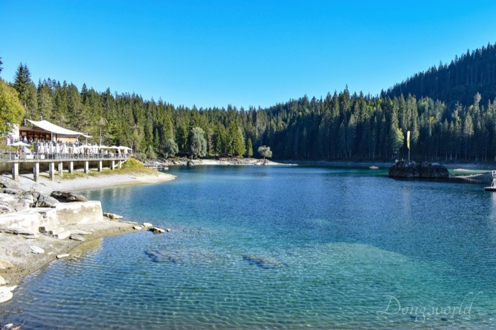
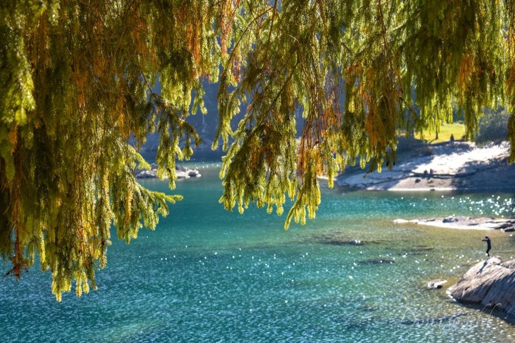
As you can see from the pictures above, either as an individual destination or a detour to your trip to the Flims region, Lake Cauma should never be missed. Known as “Lag la Cauma” in the Romansh language, meaning “Lake Siesta“, it is the jewel of Flims. Surrounded by a huge forest, which was allowed to remain on the agriculturally useless debris area of the biggest prehistoric rockslide in the Alps (the Flims Rockslide which I mentioned above), it has a wooded island in the centre, where you can relax in complete tranquillity. Particularly striking is its turquoise and cool water with a temperature between 17 and 24 degrees (in the summer). During my visit (28th October), the water was quite cold but there were still people swimming and paddling in the lake. It’s actually very similar to some other gorgeous lakes I’ve been to in Switzerland, which are perfect destinations for spending some quality family time. The facilities available after the ticket control are volleyball beach, children’s playground, lockers, changing rooms, toilet, restaurant, boat rental, lake terrace and sunbathing area.
If you want to know some other attractions close to the lake, I recommend Il Spir, a viewing platform at Conn, and the Rheinschlucht (Rhine Gorge), also known as the Swiss Grand Canyon. Overlooking the Rhine Gorge of the Vorderrhein River, the platform was designed by Corinna Menn and opened in 2006. It allows a good view of the gorge and the river lying some 400 meters below. While it took 40,000,000 years to develop the Grand Canyon in Arizona, the young Rhine dug this gorge within 10,000 years. That is the age of Flims Rockslide, which covered the original Rhine Valley with its debris. The river is still running through debris, meaning it has not reached the former valley yet. As for reaching Il Spir, there’s no public transport so you need to walk from Flims Waldhaus for around an hour. As for reaching the Rhine Gorge, there’s a train station nearby called Versam-Safien and from there, you just need to walk for 8 mins.
As I mentioned at the beginning of the post, Swiss Tectonic Area Sardona covers an entire space of 32,850 ha and can be explored by numerous hikes and excursions. In this post, I focused on some of the most amazing features of the property, that is to say, Tschingelhörner and Piz Atlas with their clearly visible Glarus Thrust, and the lower Segnesboden with its ever-changing streams. In addition, I also introduced the biggest prehistoric rockslide in the Alps – the Flims Rockslide, the waterfalls between the upper and lower Segnesboden, the karst landscape and the wonderful Caumasee. In the future, I’ll keep discovering new, interesting and impressive hiking trails and destinations in and around the property, and I’ll make sure to keep you updated. To be continued…


