This is part of a series of posts dedicated to the exploration of Swiss Alps Jungfrau-Aletsch-Bietschhorn, a UNESCO World Heritage site covering an entire area of 82,400 ha. The next few paragraphs will be about the site’s universal value (the reason why it is inscribed on the World Heritage list) and a brief introduction to various viewpoints, hiking trails and attractions in different regions in and around the inscribed area. If you have already read other posts related to the property, please click here to jump directly to the main content of this one.
As the UNESCO comments:
The extension of the natural World Heritage property of Jungfrau-Aletsch-Bietschhorn (first inscribed in 2001), expands the site to the east and west, bringing its surface area up to 82,400 ha., up from 53,900. The site provides an outstanding example of the formation of the High Alps, including the most glaciated part of the mountain range and the largest glacier in Eurasia. It features a wide diversity of ecosystems, including successional stages due particularly to the retreat of glaciers resulting from climate change. The site is of outstanding universal value both for its beauty and for the wealth of information it contains about the formation of mountains and glaciers, as well as ongoing climate change. It is also invaluable in terms of the ecological and biological processes it illustrates, notably through plant succession. Its impressive landscape has played an important role in European art, literature, mountaineering and alpine tourism.
自然世界遗产少女峰–阿雷奇冰河–毕奇霍恩峰(最早于2001年被列入)从东部扩展到西部,面积从53 900公顷扩展到82 400公顷。该遗址为阿尔卑斯高山——包括山脉最受冰河作用的部分和欧亚大陆山脉最大的冰川——的形成提供了一个杰出的实例。它以生态系统多样性为特点,包括特别受气候变化冰川融化而形成的演替阶段。该遗址因景色秀美、而且包含山脉和冰川形成以及正在发生的气候变化方面的丰富知识而具有突出的全球价值。在它尤其通过植物演替所阐释的生态和生物过程方面,该遗址的价值无法衡量。其令人难忘的景观在欧洲艺术、文化、登山和阿尔卑斯山旅游中起着重要作用。


In order to be inscribed on the UNESCO World Heritage list, sites must be of outstanding universal value and meet at least one of the ten Criteria for Selection. Swiss Alps Jungfrau-Aletsch-Bietschhorn meets
Criterion (vii): to contain superlative natural phenomena or areas of exceptional natural beauty and aesthetic importance, because the impressive landscape within the property has played an important role in European art, literature, mountaineering and alpine tourism. What’s the top 1 attraction in Switzerland? The Alps. What’s the most famous part of the Alps? The Jungfrau region. The area around Jungfrau, Aletschhorn and Bietschhorn, which includes the imposing north wall of the High Alps featuring Eiger, Mönch and Jungfrau and on the southern side many spectacular peaks and a valley system containing Europe’s largest glacier, is globally recognized as one of the most spectacular mountain regions to visit;
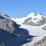
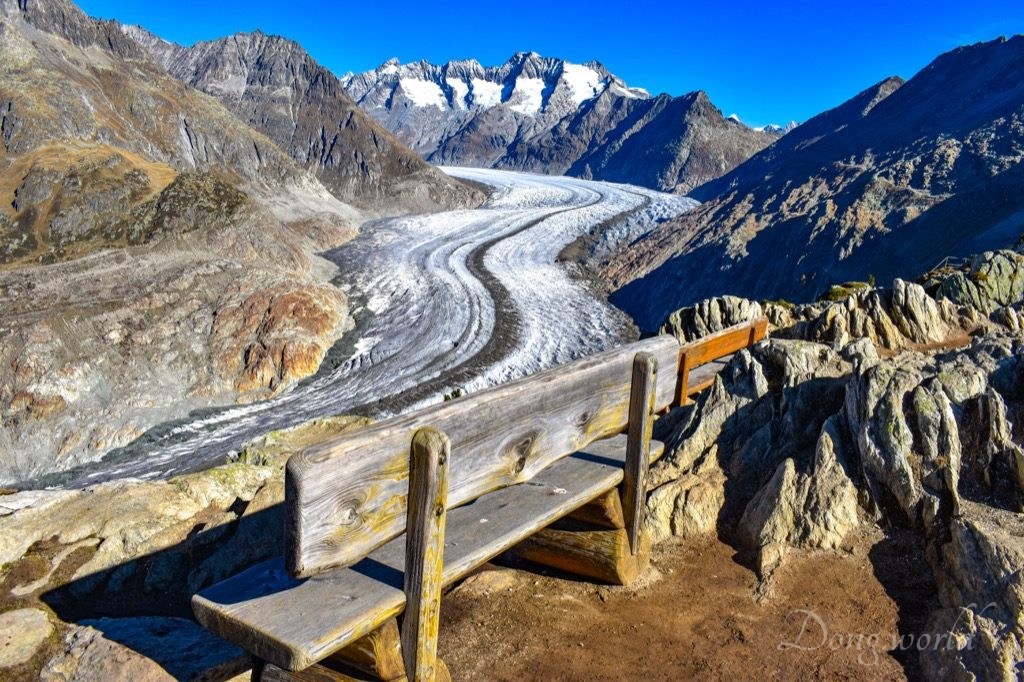
Criterion (viii): to be outstanding examples representing major stages of earth’s history, including the record of life, significant on-going geological processes in the development of landforms, or significant geomorphic or physiographic features, because the property provides an outstanding record of the geological processes that formed the High Alps and is abundant in diverse geomorphological features such as U-shaped glacial valleys, cirques, horns, valley glaciers and moraines. 20 – 40 million years ago, through uplifting and compressing, the formation of the High Alps began. Ranging from 809 m to 4,274 m high, the mountains in the property show 400-million-year-old crystalline rocks thrust over younger carbonate rocks due to the northward drift of the African tectonic plate. As the most glaciated part of the Alps, the site contains the largest and longest glacier in Europe – the Aletsch Glacier, which shows a range of classic glacial features. Furthermore, the glacier provides vital information about glacial history and ongoing processes, in particular related to climate change.
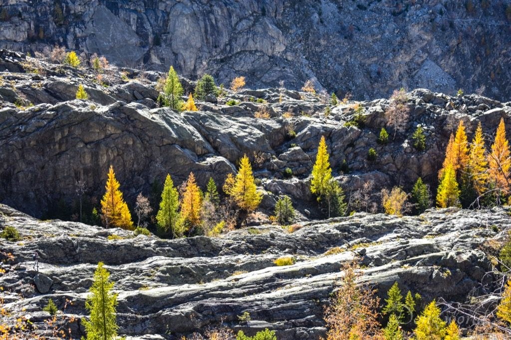
and Criterion (ix): to be outstanding examples representing significant on-going ecological and biological processes in the evolution and development of terrestrial, fresh water, coastal and marine ecosystems and communities of plants and animals, because within the property, diverse flora and fauna are represented in a range of habitats, and plant colonization in the wake of retreating glaciers provides an outstanding example of plant succession. Covering a wide range of altitudes and exposures (such as the dry southern side and wet northern side), the property includes diverse alpine and sub-alpine habitats. On the crystalline and carbonate rocks, a variety of ecosystems have evolved without significant human intervention. Particularly worth mentioning is the upper and lower tree-line of the Aletsch forest, a superb example of plant succession. The global phenomenon of climatic change, which is reflected in the varying retreating rates of the glaciers, is particularly well-illustrated in the region, providing new substrates for plant colonization.
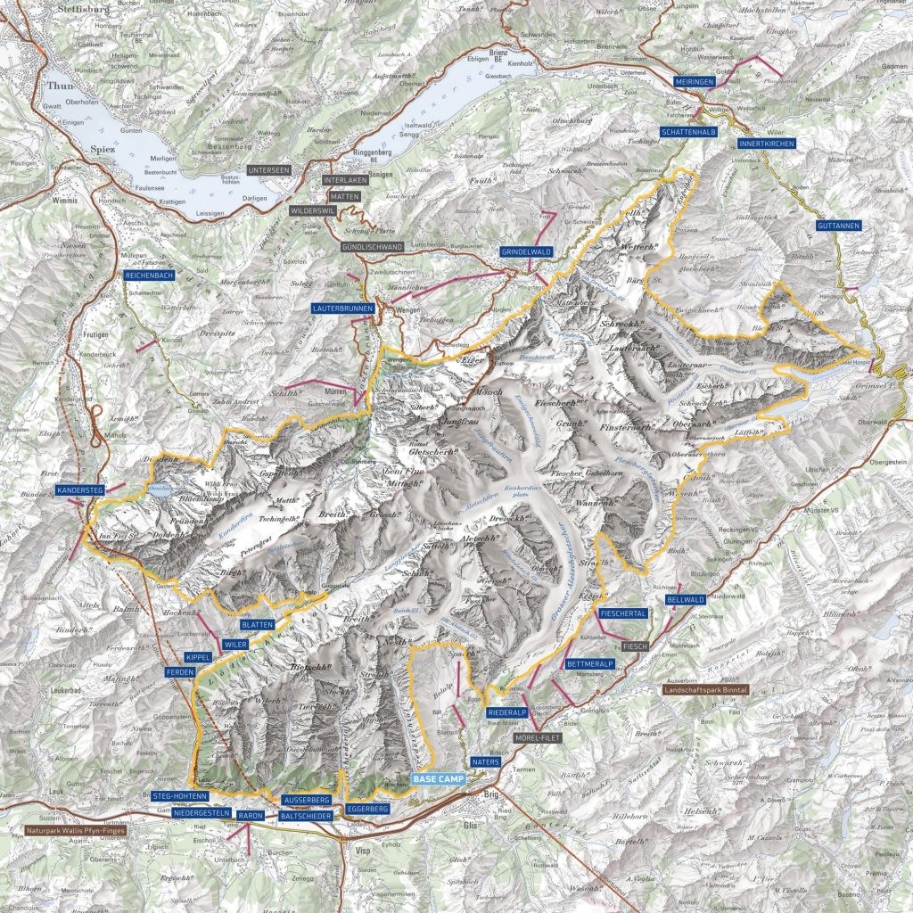
As you can see from the map above, the inscribed area is huge, so how can we explore it? Before giving you some suggestions based on my own experience and the information on www.jungfraualetsch.ch, let’s first learn some facts about the property:
- surface of the World Heritage area: 824 km2
- Population of the World Heritage region: 40,000 inhabitants
- 23 municipalities in the cantons of Valais (15) and Bern (8) are involved
- 9 mountains within the area are over 4000 meters and Finsteraarhorn is the highest peak (4274 m)
- around 50 mountains within the area are over 3500 meters
- the glaciers cover a total area of 350 km2
- the longest and largest glacier in the Alps, Aletsch Glacier (23 km) is located at the center of this protected area
- 88% of this area is without vegetation
- the Bernese Alps (Wetterhorn – Schreckhorn – Eiger – Mönch – Jungfrau – Gletscherhorn – Breithorn – Blüemlisalp) are considered one of the most famous mountain ranges in the world
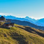
As you might have noticed, most of the inscribed area is not accessible to normal tourists as it’s made up of either high mountains or glaciers. However, there are many viewpoints on the mountains around the property, most of which are conveniently connected to bus stops or train stations by cable cars. Personally, I strongly recommend the viewpoints within and around the Aletsch Arena, which provide amazing views of the Aletsch Glacier, Aletschhorn, Bietschhorn, Jungfrau, Mönch, Fiescherhorn and so on, and within the Jungfrau region including Grosse Scheidegg, First, Schynige Platte, Männlichen, Jungfraujoch, Schilthorn and so on, from which you can see clearly the northern wall of the High Alps featuring the signature Swiss skyline of Eiger, Mönch and Jungfrau. If you are a hiker, you have many more options and can get a closer look at the World Heritage site. Besides the numerous hiking trails in Jungfrau and Aletsch regions, I recommend you checking out the Lötschental Valley, Kandertal Valley (Gasterntal Valley and Lake Oeschinensee), and Rosenlauital Valley (Rosenlaui Glacier Gorge).
Exploring the regions I mentioned above will probably take you a very long time because they offer numerous viewpoints, hiking trails and attractions, and after that, I believe you will have a very good understanding of the universal value of the property such as its unparalleled beauty, exceptional record of the formation of the Alps, excellent demonstration of diverse geomorphological features and remarkable representation of on-going ecological and biological processes. If you are still not satisfied and want to have a completer experience, try visiting the municipalities of Raron, Eggerberg, Guttanen (Grimselwelt), Innertkirchen and Meiringen, where you will find more activities closely or remotely related to the World Heritage site. I read from the official website that there’s a long tour which allows you to hike around the property and discover and learn about it in 15 stages. The booklet providing relevant information regarding the routes and attractions is called «Key to the Alps», which is unfortunately only available in German. I think, even if you don’t speak German or plan to take the complete tour, the booklet should shed some light on the planning of your own expedition. Alternatively, there is a fold-out map available in English with overview and tips regarding highlights of the World Heritage site. I can send the digital version to you upon request and I’m sure it will also give you some inspiration.
- To find out the destinations and highlights recommended by jungfraualetsch.ch please click here.
- To find out the destinations and hiking tours recommended by myswissalps.ch please click here.
As I mentioned above, most of the inscribed area is not easily accessible to normal visitors and some parts of it are not clearly visible from the surrounding viewpoints. How can we gain deeper insights into this mysterious world then? Last but not least, don’t forget to visit the municipality of Naters, where the World Nature Forum Information and Visitor Center of the UNESCO World Heritage site Swiss Alps Jungfrau-Aletsch is located. In order to protect this extraordinary natural heritage and to promote sustainable development of this region, 23 municipalities within the cantons of Bern and Valais together with the Swiss Federation have agreed to work in collaboration. The World Nature Forum (WNF) is the base camp of this commission and its Information and Visitor Center provides us with necessary knowledge about this region and helps to raise our awareness of the importance of its protection. If it’s inconvenient for you to reach the area, you can also learn about it at home. On the official website, 19 thematic brochures (more in German) giving insights into the uniqueness, diversity and beauty of the region are available and can be downloaded as pdf. The thematic brochures are about agriculture and settlement, tourism and traffic, fauna and flora, water, culture, glacier, climate, and mountains while the regional brochures are about Oberhasli, Naters, Lötschental, “Suonen”, Raron – Niedergesteln, Grimselwelt, Kandertal, Grindelwald, Lauterbrunnen, Aletsch Region, and Bellwald.
I hope my introduction above gives you a general idea of why the Jungfrau-Aletsch-Bietschhorn region is so valuable and how to explore and learn about it. In a series of posts about the World Heritage site, I’ll focus on the hikes, viewpoints and tours I experienced and provide you with practical information, tips as well as detailed introduction to the geological and ecological processes, geomorphological features and ecosystems which are related to the property.
1. Lauterbrunnen Valley


Lauterbrunnental is one of the most spectacular valleys in Switzerland. Due to its U-shape, it’s depicted in many school books as a classic example of trough valley. In the Bernese Oberland around 25,000 years ago, ice covered the mountainous landscape and the V-shaped notches that streams had previously dug into the rock. Only the highest peaks could be seen. Nothing seemed to move but under their enormous weight, the ice masses which were up to over 1000 meters thick, were moving on the slopes of the Jungfrau massif. Its pressure heated the glacier bottom and consequently, the ice began to glide on the melting water, transporting huge amounts of rubble, which varied from small pebbles to huge boulders. Gravel at the bottom acted like sandpaper and kept rubbing, pushing, sanding and scraping the ground and flanks, changing the V-shaped valley slowly to a new shape. The force in the center was the strongest, which resulted in the flat valley floor bounded by hundred-meter-high cliffs, while the force at the edges was much weaker, which resulted in the terrasse-like, gently inclined plateaus, which mark the peak of the glacier. The explanation to the formation of the valley is based on what I read from the website of the Jungfrau region. If you want to know more about it, please click here.
The valley with its 72 waterfalls, gigantic rock faces, mountain peaks and alpine meadows has inspired many writers including Johann Wolfgang von Goethe and J. R. R. Tolkien. As I read from Wikipedia, Goethe’s poem “Gesang der Geister über den Wassern” (“Spirit Song Over The Waters”) was written while he stayed at the parish house near the Staubbachfälle (Staubbach Falls) in Lauterbrunnen, and after hiking from Interlaken to the Lauterbrunnental in 1911, the landscape of the valley provided Tolkien with the concept and pictorial model for his sketches and watercolours of the fictitious valley of Rivendell. What’s more, Lauterbrunnen was featured in several scenes from the 1969 James Bond movie On Her Majesty’s Secret Service.
If I remember correctly, I’ve been to Lauterbrunnen four times already. Once on my way to Jungfraujoch, twice on my way to Schilthorn – Piz Gloria and once on my way to Männlichen. I’ve been visiting the attractions around Lauterbrunnental but unfortunately I haven’t really explored the valley itself yet. As I read from the website of the tourism office of Lauterbrunnen, there’s a flat walk (distance: 7.97 km, difficulty level: easy-medium, time requirement: 2.5 h, highest point: 922 m, ascent: 120 m) through the valley from the village (Lauterbrunnen) to Stechelberg which offers deep insights into the 72 waterfalls including the famous Staubbach Falls and Mürrenbach Fall gushing down from the vertical cliff faces, some of which are several hundred meters high. As I read from the website of the tourism office of Stechelberg, in addition to numerous waterfalls, the Rear Lauterbrunnen Valley, which is located inside the World Heritage site Swiss Alps Jungfrau-Aletsch-Bietschhorn, also has a wealth of scenic and cultural assets. Therefore, six World Heritage Themed Trails (alpine economy, mountain hotels, power spots (for meditators), waterfalls, history and fables, and flora and fauna) were created, each of which leads from the information panel in Stechelberg into the rear valley. Just follow the symbol of your chosen theme on the brown signs and on the way, you will see info boards linked to the specific theme. In the future, preferably in summer, I’d love to walk through the valley (from the village to Stechelberg and then take one or two of the themed trails) and discover its waterfalls and traces of the retreat of glaciers.
Besides the hiking trails mentioned above, there are some more highlights in and around the valley and now I’ll introduce them to you briefly. In the future, I’ll write detailed posts about them and you can check them out later.
- Jungfraujoch (3454m) – the Jungfrau railway has been plying its way through a 7-km-long tunnel inside Eiger and Mönch to the highest station in Europe, the ultimate excursion destination in the Bernese Oberland, since 1912. If you come to Switzerland, this is an experience you shouldn’t miss.
- Kleine Scheidegg – as the starting point of the rack railway to Jungfraujoch, it provides an impressive view of the north face of Eiger and the four-thousand-meter peaks of Jungfrau and Mönch. It’s also the starting point of the easy hike Kleine Scheidegg – Männlichen (distance: 4.3 km, duration: 1 h 15 m, ascent: 1 m, descent: 170 m).
- Männlichen – starting point of the Royal Walk to the summit of Männlichen and of the easy hike Männlichen – Kleine Scheidegg (distance: 4.3 km, duration: 1 h 15 m, ascent: 1 m, descent: 170 m), both of which provide an amazing view of the High Alps.
- Schilthorn – the panoramic revolving restaurant at the summit, Piz Gloria (2970 m), was featured in the 1969 James Bond movie On Her Majesty’s Secret Service and provides an amazing view of 40 mountain peaks and 20 glaciers including Titlis, Eiger, Mönch, Jungfrau and even Mont Blanc. At Birg, the intermediate station between Mürren and Schilthorn, challenge yourself on the Trill Walk, a 200-meter cliff pathway under the cableway station.
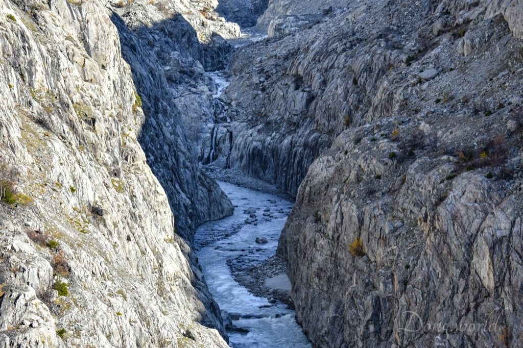
- Trümmelbach Falls – one of the wildest glacier ravines in Europe with 10 waterfalls of the Trümmelbach hidden amongst the rocks. In Europe, they are the only glacial waterfalls which are inside the mountain and still accessible to the public. A UNESCO World Natural Heritage. I’ll talk about this site in detail in the next chapter.
- Staubbach Falls (as you can see in the 1st picture above) – on the edge of the village of Lauterbrunnen, the water plunges almost 300 meters from an overhanging cliff face. It was the inspiration for Goethe’s famous poem “Spirit Song Over The Waters”. From the foot of the waterfall, a path leads up to the Staubbach Gallery, where the fall can be observed up close. After rain, and early in the season, the force of the stream above the fall is strong enough to carry the water clear of the precipice, and the whole mass descends in a condition of liquid dust, which sways to and fro with gentle breeze.
- Isenfluh – one of the typical Swiss mountain villages and above it, you get an impressive view of Eiger, Mönch and Jungfrau.
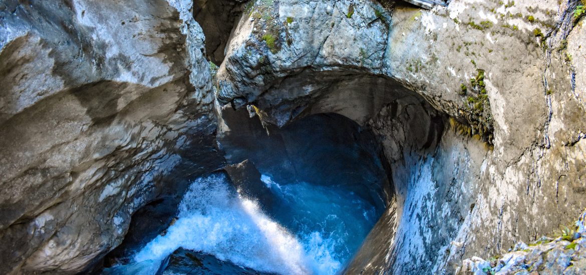
2. Trümmelbachfälle (Trümmelbach Falls)


On my way to Schilthorn – Piz Gloria, the detour to the Trümmelbach Falls was absolutely a wise choice. First of all, this attraction is located inside the World Heritage site Swiss Alps Jungfrau-Aletsch-Bietschhorn and at the same time easily accessible to the public. Secondly, as I read from the info boards on site,
- “The Trümmelbach alone drains the mighty glacier defiles of Eiger, Mönch and Jungfrau and carries 20,200 tons of boulder debris per year.”
- The drainage area of Trümmelbach is 24 km2, covering the north and west walls of Mönch (4099 metres), Jungfrau (4158 metres) and Eiger (3970 metres) and the sources that rise on Lauberhorn (2472 metres) and extend to Wengernalp. Half of of area is covered by glacier, firn, ice and snow.
- The 10 waterfalls are “the only glacial waterfalls in Europe inside the mountain and still accessible“.
- The flow rate of the falls can reach up to 20,000 liters per second.
I was thinking, “As a World Heritage fan, how can I miss the opportunity to admire such a natural wonder?” Don’t worry, it’s not a big attraction so you can add it easily to your trip to Lauterbrunnental. In the following paragraphs, I’ll first give you some practical information and tips and then I’ll show you and explain more about the waterfalls and steep-sided narrow gorge that they sculpted.
2.1 Practical information
The Trümmelbach Falls are open:
- from the beginning of April to the beginning of November: 9:00 – 17:00
- in July and August: from 8:30 to 18:00
Ticket prices:
- Adults: CHF 11.-
- Children: CHF 4.-
- Special price available on request for groups of 10 or more people
The site is conveniently connected to Lauterbrunnen by bus No. 141, which runs between Lauterbrunnen train station and Stechelberg Hotel and stops at Trümmelbachfälle, Schilthornbahn, etc.
If you plan to drive here, you can find it easily on GPS. Close to the entrance, there’s a large, free parking lot, a self-service restaurant with a scenic terrace and a small souvenir shop.
2.2 Tips
- Due to safety reasons, children under 4 years old, strollers, or dogs are not allowed;
- do not lean over the guardrails and take care of your children;
- take a cleaning cloth with you both for your glasses and cameras. Some viewing platforms are rather close to the falls and the strength of the flow should not be underestimated;
- close to the entrance you should see an info board showing where the 10 waterfalls are and how to reach them. Basically, at the bottom of the gorge, you can walk a bit to visit waterfalls No. 1 & 2 and then back. Then you take a lift to the middle of the gorge and walk to the top, during which you will see four falls (7 – 10) and rugged rock formations inside the mountain. Return to the middle of the gorge (upper station of the lift) and walk to waterfall No. 6 and return. Take the stairs down to the bottom and on the way you will see the last four falls (2 – 5);
- on your way down from the middle to the bottom of the gorge, don’t miss the Corkscrew Fall, which is a marked highlight of the attraction;
- inside the mountain, it’s fun looking for falls between the rocks, but the stairs and path can be rugged and wet so be careful when you walk;
- it’s difficult to take nice pictures inside the mountain because of the lighting but if you are professional, maybe bring your tripod as I didn’t see any signs forbidding it;
- in general the gorge is not very high so I believe with help of the lift, most people can make it.
Now, let me show you what you can expect inside the Trümmelbach Gorge.
2.3 The gorge and falls
From the last Ice Age about 15,000 years ago until 1877, all the Trümmelbach Falls except the lowest part were neither approachable nor visible to visitors. They were hidden inside the mountain, which is why the name “Trümmelbach” does not convey a visual impression but an acoustic one. “Trümmelbach” comes from “Trommelbach”, which means a stream that sounds like a drum. The flow rate of the falls varies greatly. From December to March there is just a little stream trickling down and in April and October the flow measures a few dozen liters a second. However, between April and June, when the snow melts, between June and September, when the glacier melts, and after heavy rain and thunderstorms, the flow rate can reach 20,000 liters per second.
Waterfalls No. 1 & 2


Turn right at the bottom of the gorge and you will see the first and second waterfalls. Honestly I think the second waterfall (as you can see in the 2nd picture above) is one of the most impressive of the ten because it’s long and rough. I could’t capture all of it within one picture so if you want, I can send you a video in which you can hear it roaring.
Waterfalls No. 7 – 10


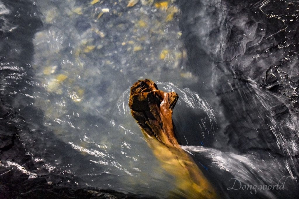

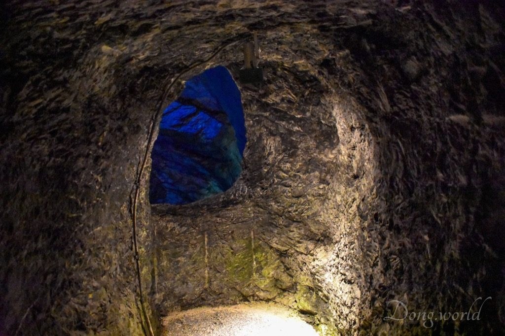
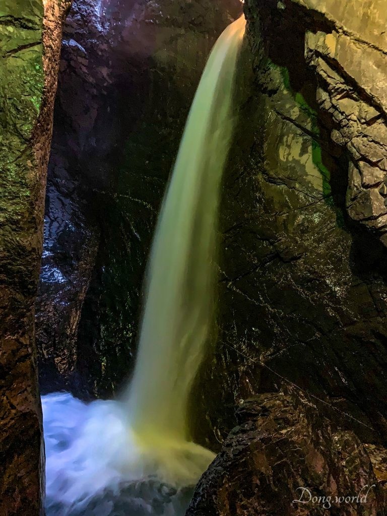
After taking a lift to the middle of the gorge, let’s start the ascent to the top. The tunnel lift, which is essentially a funicular with a counterweight, was constructed in 1913 when access to the three upper falls inside the mountain was made possible. The current cabin, whose walls and roof are made of glass, was constructed in 1983 and is the third generation since the original construction in 1913. A little higher than the lift exit you will find a platform to admire waterfall No. 7. Walk along the semicircular staircase with a mild scent and you can enjoy the fall from above. The top of the staircase marks the entrance to the interior of the mountain, where rugged rock formations of peculiar shapes and three additional falls can be seen. This part of the attraction is really a world of water and rock because in a comparatively closed space like this, though there were other tourists, all I could hear was the sound of water flowing, falling, splashing and smashing rocks. There are a few viewpoints, some of which are platforms while the others are rock openings, and you need to find the best ones to appreciate the three falls hidden in the gorge. For me, the most impressive of the three was the fall you can see in the 3rd picture above. It wasn’t big but very fast. Against the black surface, it was gushing down like silk.

One of the reasons why Swiss Alps Jungfrau-Aletsch-Bietschhorn is inscribed by the UNESCO as a World Heritage site is that it provides an outstanding record of the geological processes that formed the High Alps and is abundant in diverse geomorphological features. As we walk up and down, we discover and experience the gorge closely but what does it tell us about the formation of the High Alps? As I read from the official website, Prof. Dr. Hottinger from the Geological Institute of University of Basel writes:
“The rock eaten away by the Trümmelbach consists of thick beds of limestone (2). These were deposited as calcareous mud 140 million years ago, in the Upper Jurassic period, in the shallow sea that then covered the entire European continent. 100 million years later, the Bernese Oberland region was included in the process that led to the creation of the Alps. The folding of the earth’s crust led to the limestone (2) being covered over by several mighty strata (3) that had been deposited further to the south (the Wildhom layer), which compressed it. The plications and flow lines are still clearly visible on the polished walls of the Trümmelbach. They testify to the enormous pressures to which these strata (3) were exposed as the Alps were formed. Even the earth’s crust below the limestone layer, consisting of crystalline primeval rock (1), which had at one time formed the bed of the shallow Jurassic Sea, was caught up in this folding movement. Coarse flakes of primeval rock were thrust upwards and today constitute the peak of the Jungfrau (1). They rise up high above the marine deposits that originally covered them.
However, the Alps did not attain their present height until later, about 10 million years ago, when compaction by uplift commenced that is still going on. At the same time rain, snow and ice began to wear away the mountain peaks and to carry the rock down to the lowest levels. This is the key to an understanding of the history of the Alps, which can be studied by examining the steep slopes of valleys to find out what kinds of rock they consist of and the way they are piled up in strata on top of each other. 500’000 years ago the glaciers of the Ice Ages began to carve out the valleys we know today and to clear away a lot of the old debris. The smooth rocky walls of the Lauterbrunnen Valley bear witness to the erosive force of the ice that at one time filled the valley right up to its rim (4).
Today the Staubbach and its sister streams pour freely as waterfalls over cliffs hollowed out by the ice. But the Trümmelbach already began to bore away at the rock while the valley was still full of ice (4). The melting snow and ice that poured off the sides of the glacier set in motion a so-called moulin, or glacier mill, which must have continued over much of the last Ice Age and fortunately was not blocked off by the scree of a moraine. Through the shaft formed by this moulin the water from the melting snow and ice on the surface found its way down to the base of the glacier and then bubbled out from beneath the ice somewhere near Lauterbrunnen.
In this way the Trümmelbach has been thundering through the rock for the last 15,000 – 20,000 years, as an expressive testimony to the last Ice Age.”
If you are interested in geology, you probably enjoyed the explanation above. If not, all you need to know is that the glacier gorge and the floor and cliffs of Lauterbrunnental provide significant evidence of the formation of the High Alps.
Waterfall No. 6


After returning from the top to the middle of the gorge (where you exited the lift), follow the sign and stairs to waterfall No. 6. Please note, this is a dead path so after enjoying the fall, you need to return to the middle and follow the other path down, on which you will see waterfalls 5 – 2.
Waterfalls No. 5 – 2


On the way down, pay attention to the Corkscrew Fall, which is marked by a sign. I assume its name comes from the corkscrew-shaped channel, through which the stream flows/falls like a snake.
The site features 400 meters of galeries, 5 tunnels, 30 meters of bridges, 16 floodlights and 32 spot lamps, which make sure that visitors can see the inside of the mountain with little natural light and have great views of the 10 waterfalls from various angles. In the precipitous sides of the gorge, which are basically
inaccessible to man, one can find primeval mountain woodland with alpine roses, rare ferns and lilies and in cold rainy days and in winter, the gorge provides shelter for ibex and chamois.
As I mentioned at the beginning of the post, the UNESCO World Heritage site Swiss Alps Jungfrau-Aletsch-Bietschhorn covers a huge area (82,400 ha.) and can be admired from numerous viewpoints and explored through many hiking trails and tours. In this post, I focused on introducing the Lauterbrunnen Valley and mentioned briefly the highlights in and around it. The second chapter is dedicated to the Trümmelbach Falls and Gorge, which together with the Rear Lauterbrunnen Valley are located inside the World Heritage property. The representative glacier gorge and waterfalls as well as the trough valley (U-shaped valley) are not only spectacular geomorphic features of unparalleled beauty but also witnesses to the geological processes that created the Alps. In the future, I’ll keep discovering interesting and impressive viewpoints and hiking trails in and around the property, and I’ll make sure to keep you updated. To be continued…