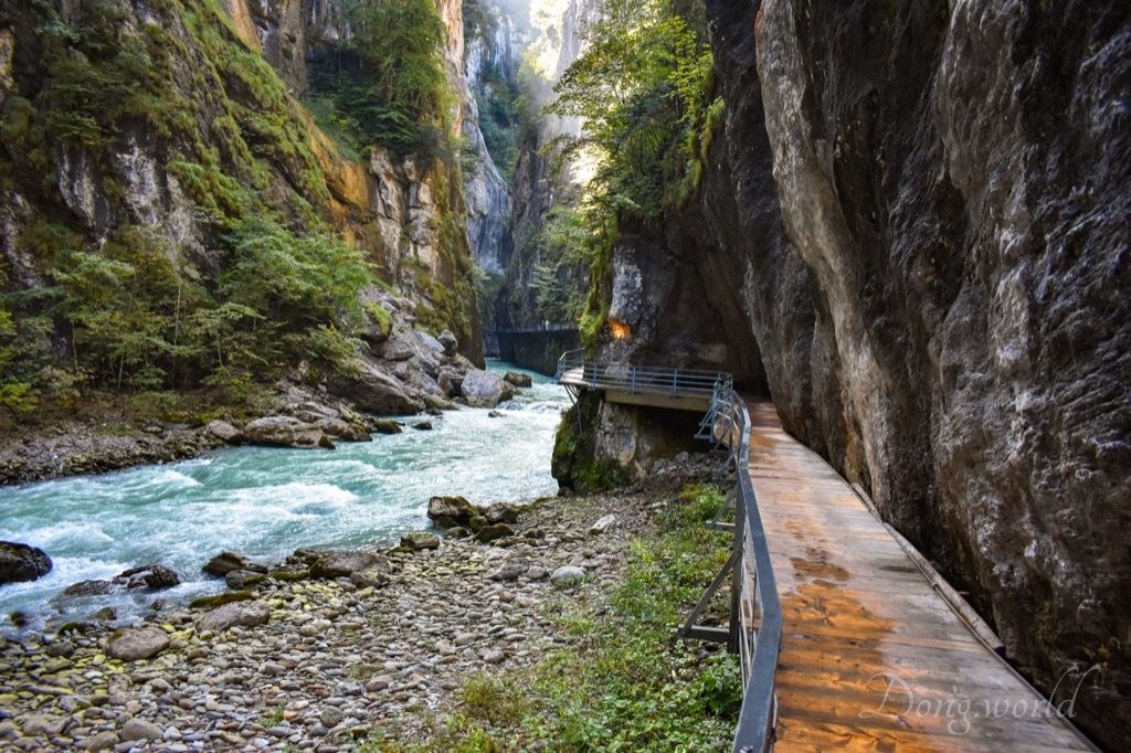
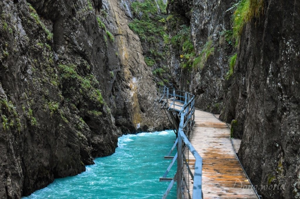
Suggested by the local tourism office, I took a 2 h detour to Aare Gorge during my visit to Meiringen and the Reichenbach Falls. I can assure you the time was very well spent and if you haven’t been to any gorge in Switzerland yet, you’ll certainly be amazed. First of all, what is a gorge? A gorge, or a canyon, is a deep cleft between escarpments or cliffs resulting from weathering and the erosive activity of a river over geologic timescales. The most famous example is probably The Grand Canyon, a steep-sided canyon carved by the Colorado River in Arizona, United States. Compared to The Grand Canyon, which is 446 km long, up to 29 km wide and up to 1,857 m deep, Aare Gorge is much smaller, but do you know what here beats the most famous canyon in the world? In my opinion, it’s the water of Aare river with its milky cyan color. When we visit the gorge, it will keep us company all the way through. In the next few chapters, I’ll first give you some practical information and tips for a smooth and pleasant trip and then, I’ll introduce to you the gorge. In the third chapter I’ll walk you through the gorge and focus on its most interesting and spectacular parts.
1. Practical information


Opening hours (2018)
- West Entrance (close to Meiringen): 30th March – 4th November: 08:30 – 17:30
- East Entrance (close to Innertkirchen): 10th May – 4th November: 08:30 – 17:30
- if you want to visit the gorge in the next years, please click here for updated information.
Ticket prices (2018)
- Adults: CHF 9.-
- Children under 6 years old: free
- Children 6 – 16 years: CHF 5.-
- Funicular and Aare Gorge combined ticket: Adults CHF 16.-, Children (6-16) CHF 11.-
- for information about group prices please click here.
Please note:
- the gorge has a West Entrance (close to Meiringen) and an East Entrance (close to Innertkirchen) and the Meiringen-Innertkirchen-Bahn has stops on both ends, so it’s your choice to walk from the west to the east and then take the train back or the other way round;
- in July and August, both entrances are open till 18:30;
- on Thursdays, Fridays and Saturdays in July and August, there is a special program called “Floodlit Illumination“, during which the gorge can be visited in the evening (18:30 – 22:00). However, please remember only the West Entrance will be open during the event;
- in general it’s easy to walk through the gorge, which is 1.4 km long, so it’s a family-friendly destination. If you keep walking without making any stops, you can finish the trail in 45 mins;
- on the way there are 14 info points with information (available both in German and English) about the gorge;
- combined tickets (Funicular and Aare Gorge) are available at both entrances to the gorge and at the funicular station;
- as I learnt from the staff, there’s a hiking trail through the forest connecting the west and east ends;
- the section between the West Entrance and the middle of the gorge is wheelchair accessible;
- at the West Entrance there’s a restaurant and playground for children while at the East Entrance there’s a snack bar;
- dogs are allowed but must be kept on a leash;
- considering the gorge is a narrow valley between steep rocky walls, the sun won’t shine on it completely, not even at midday. If you like photography, I recommend you visiting it either early in the morning or late in the afternoon or even on a cloudy day because the lighting will be more balanced.
2. Aare Gorge

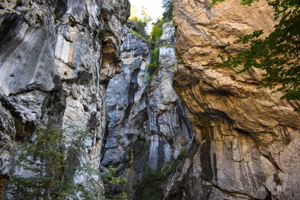
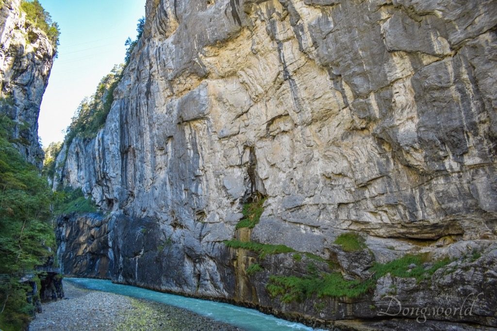
The rock formation separating the municipalities of Meiringen and Innertkirchet is called the “Kirchet” and consists mainly of very hard limestone. This formation was created in the Cretaceous period around 130 – 160 million years ago as ocean sediment, which hardened to limestone over the years. When the alps were formed around 15 million years ago, the limestone in the area of Kirchet remained unbroken and was barely moved. Due to its (Kirchet) solidity and resistance to water and ice, the glaciers of the ice age, which began around 1 – 2 million years ago, were able to erode the cliffs, but not to carry them away.
In the first warm period, as the glaciers receded, the water eroded a gorge through the cliffs. In the following cold period, the glacier once again covered the Kirchet and filled it with moraine. During the next warm period, the melting water did not wash out the moraine, but instead cut a new gorge between the cliffs. According to Müller’s detailed observation, five more gorges exist in the Kichet (which make the total amount of gorges in the area seven), which were created during the ice age, and are partially or completely filled with moraine. The “Lautere Schlucht”, which begins at the car park at the West Entrance and runs more or less parallel to the present gorge is a good example thereof.
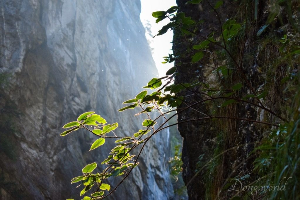
After going though the gorge, you will notice its environment is rather extreme, which results in the sparse vegetation. For example, parts of it are extremely dry while some other parts are extremely wet and parts of it get enough sunshine while some other parts are in the shadow all year round. Due to limited food, accessibility and living space, there is fish living in the stream and around 10 kinds of birds nesting in the trees, but no large mammals. Now, let’s see some facts and figures about the gorge.
- Length: 1,400 meters
- Narrowest place: 1 meter wide (Kleinen Enge)
- Widest place: 40 meters wide (Grossen Runs)
- Highest place: 180 meters
- Highest measured water level: 5 meters
- Flow time through the gorge: around 11 mins
- Average water speed on the surface: 2 meters/second
Now, I’ll take you to walk through the gorge and we will stop at the 14 info points on the way.
3. A walk through the gorge
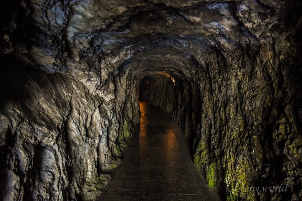
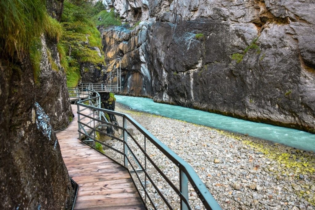
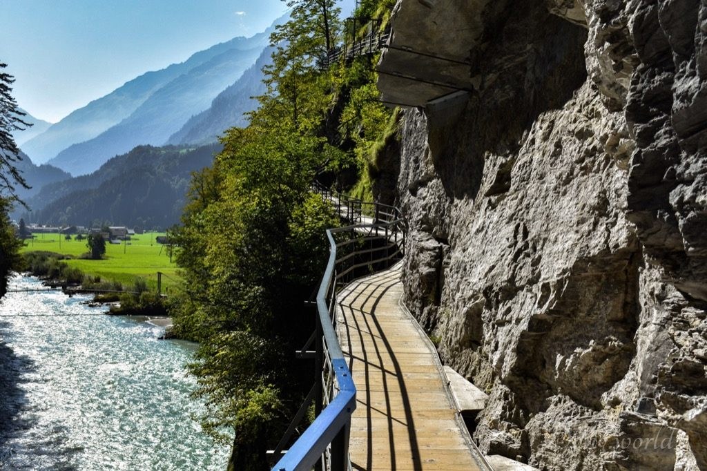
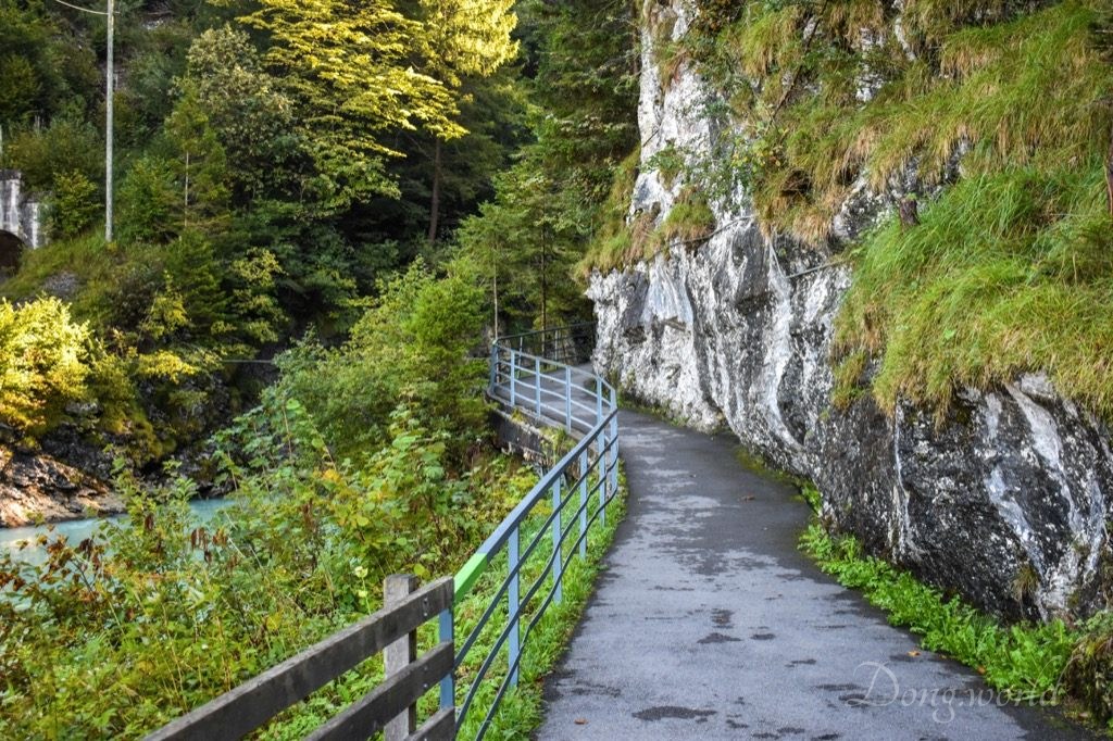
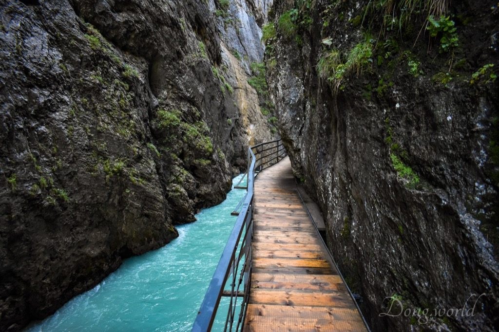
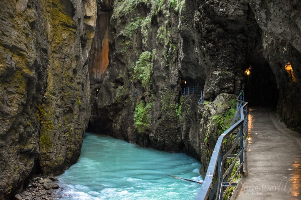
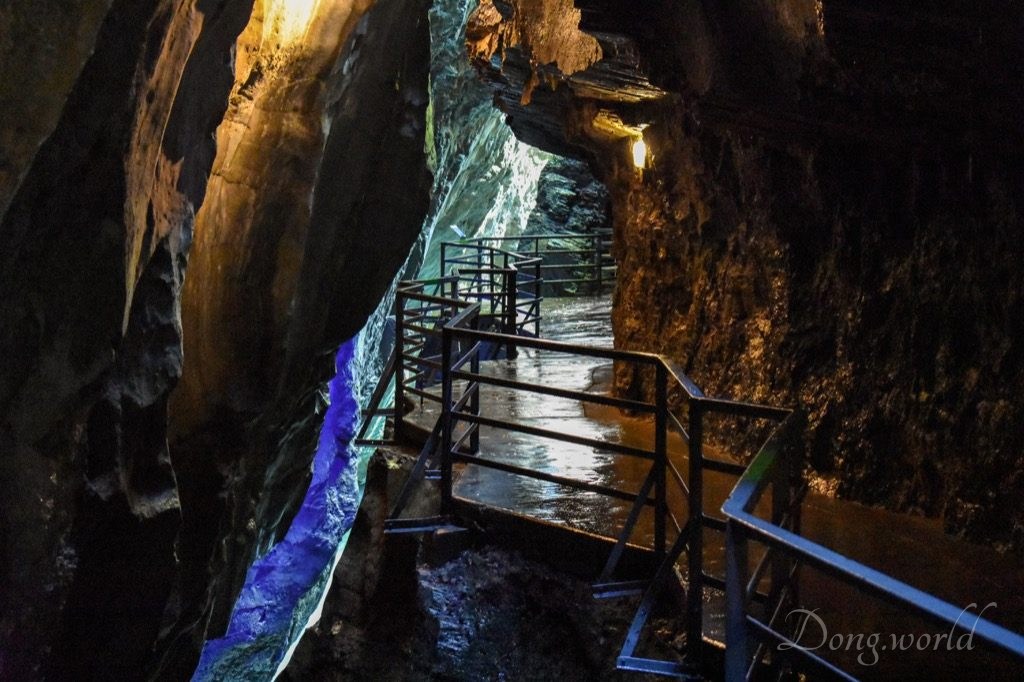
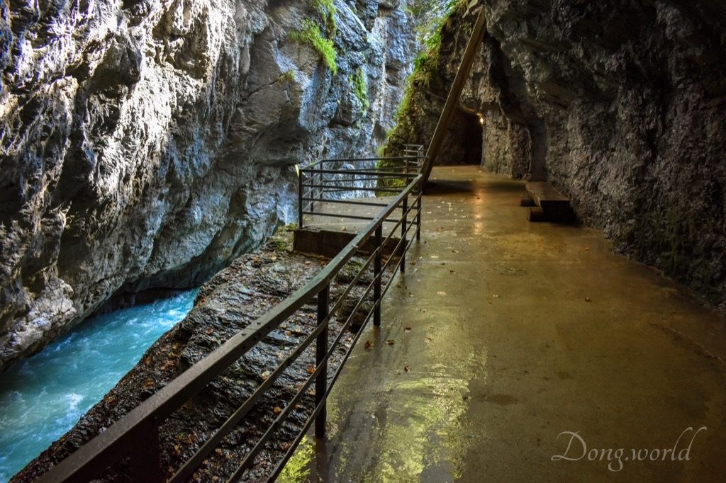
I walked from the West Entrance to the East Entrance and took the MIB (Meiringen-Innertkirchen-Bahn) train back, but as I mentioned in the tips, it totally depends on you where you want to start and end your trip. At the ticket counter, you can get two brochures, one of which provides a brief introduction to the gorge and its surrounding facilities (such as restaurant, playground, parking space (free), etc.), while the other one shows a map marked with 14 info points along the way. According to my experience, the points marked on the brochure are slightly different from the info boards on site, which I assume is because the brochure is outdated. For example, in the gorge, info point No. 14 is about the “Ahornifad” while on the brochure it’s about the suspension bridge connecting the East Entrance to the MIB station, “Aareschlucht Ost”. Anyway, I believe you won’t miss the info boards as they are rather eye-catching so you can just ignore the brochure. In the gorge, most of the path is a wooden construction on a metal frame cantilevered out from the wall, while close to the West Entrance, there are some short stretches in tunnel. Info point No. 1 is about the construction history of the pedestrian route and a general introduction to the gorge including its geology, flora and fauna and facts and figures, which I mentioned in the previous chapter already. Now, let’s start with info point No. 2.
Info point No. 2: water and glacial erosion (weathering)
Did you know:
- the Aare river began gouging its way through the gorge around 150,000 years ago;
- with the pressure of water, rocks and ice particles gouged their way from above to form this gorge;
- hard quartz particles ground down the “soft” limestone cliffs;
- glacier moraine still continues to grind down the cliffs?
Also at this info point, by comparing water in three containers with different contents and their grinding forces, you can learn about how cliffs are eroded by water of different qualities.
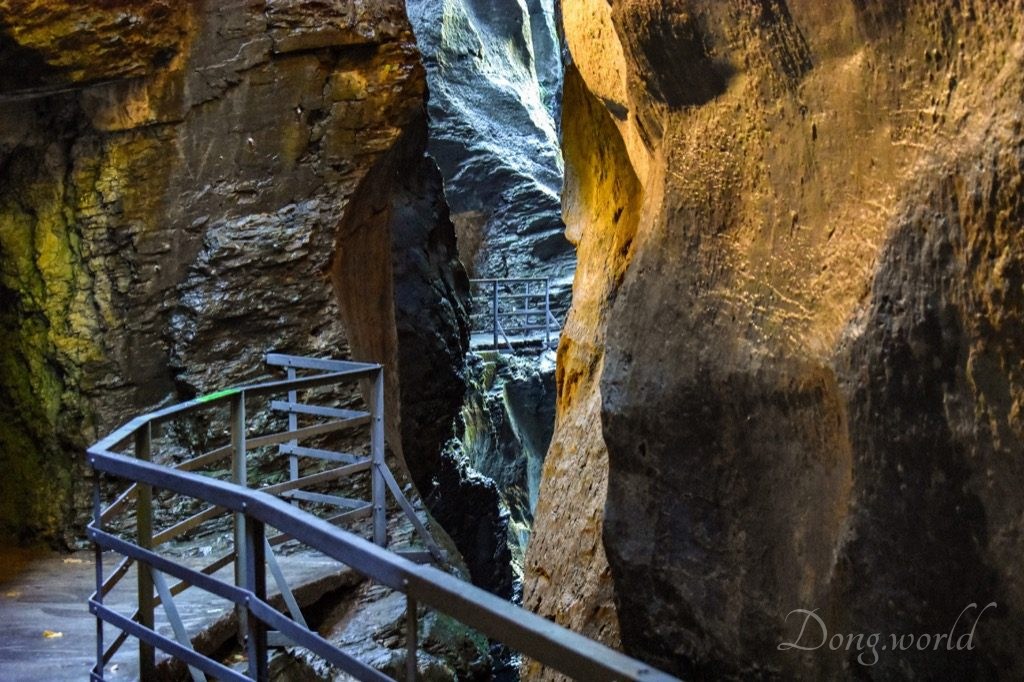
Info point No. 3: Kleinen Enge
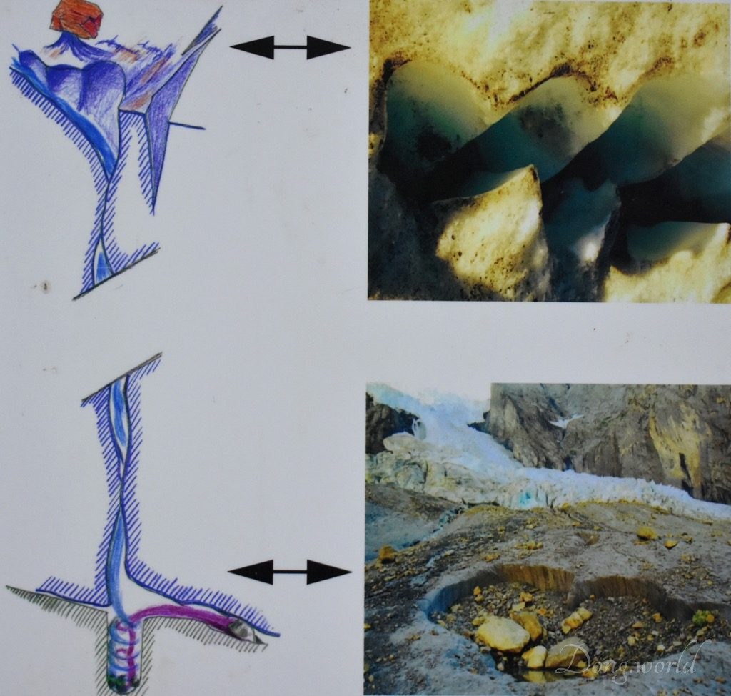
This is the narrowest part of the gorge, which is 1 meter wide. Close to it was an imposing glacier moulin or glacier mill, which is a roughly circular, vertical to nearly vertical well-like shaft within a glacier or ice sheet which water enters from the surface.
Info point No. 4: construction of the pathways
The gorge has already been open to the public for around 130 years and maintenance work is still carried out in the original way, which has been implemented since 800 years. If you are interested in the construction history of the pathways, please click here.
Info point No. 5: Grosse Enge
The smooth surface of rocks here are an example of mechanical erosion.
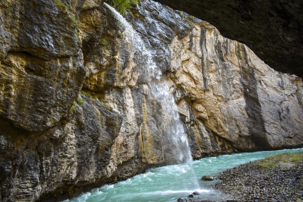
Info point No. 6: the Schräybach & info point No. 7: chemical weathering
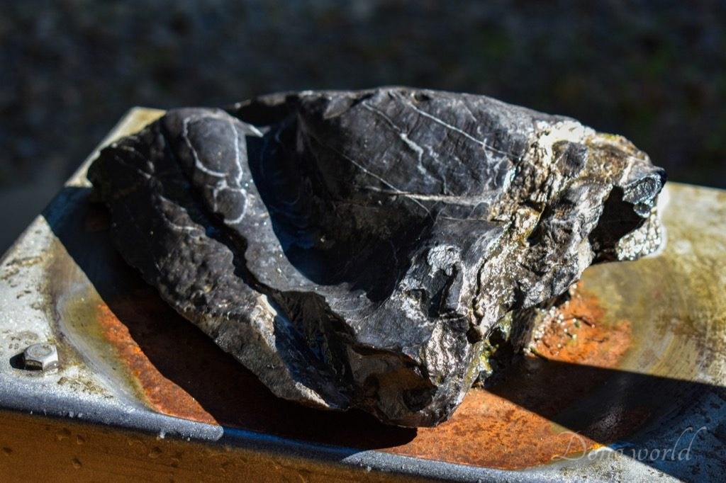
The Schräybach is a waterfall within the Aare Gorge and is a typical example of chemical weathering and mechanical erosion. Acidic rainwater filters down through the earth onto the bedrock and then eats its way further and further into the limestone cliffs. However, over the years, the fall is getting smaller and smaller. Info boards 6 and 7 are located together and in between we see a rock which is a perfect example for making a comparison between mechanical erosion and chemical weathering. First of all, we need to understand the difference between erosion and weathering. Weathering is the process where rock is dissolved, worn away or broken down into smaller and smaller pieces while Erosion happens when rocks and sediments are picked up and moved to another place by ice, water, wind or gravity. Normally, the rock is ready for erosion once it has been weakened and broken up by weathering. Secondly, we need to understand two different types of weathering, that is to say, mechanical weathering and chemical weathering.
- Chemical weathering involves a reaction of substances, such as an acid, to the minerals that make up a rock and oxygen in air may also cause chemical weathering when it interacts with iron in soil,
- while mechanical weathering occurs when agents such as animals, plants, water, wind and people break rocks physically into pieces.
As you can see from the stone above, chemical weathering usually leaves a rugged surface while one resulted from mechanical weathering is usually comparatively smooth.
Info point No. 8: Grossen Runs
In the gorge, this is not only the widest part, with the width at the bottom reaching up to 40 meters, but also the largest rubble and sand deposit.
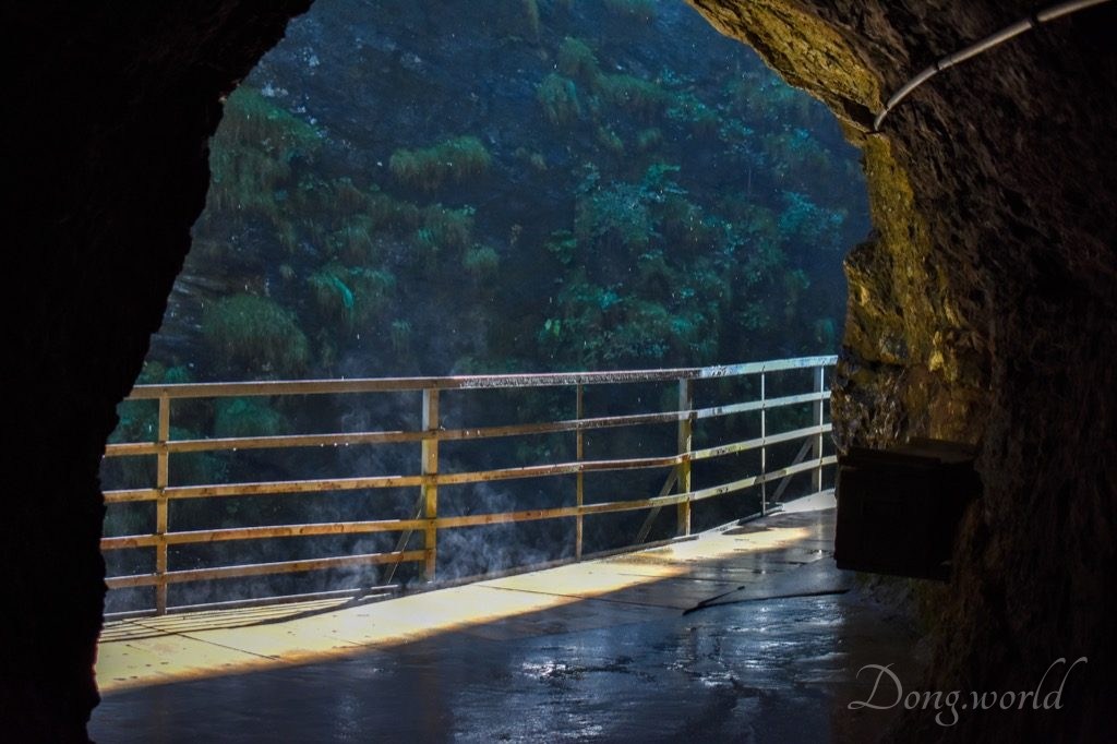
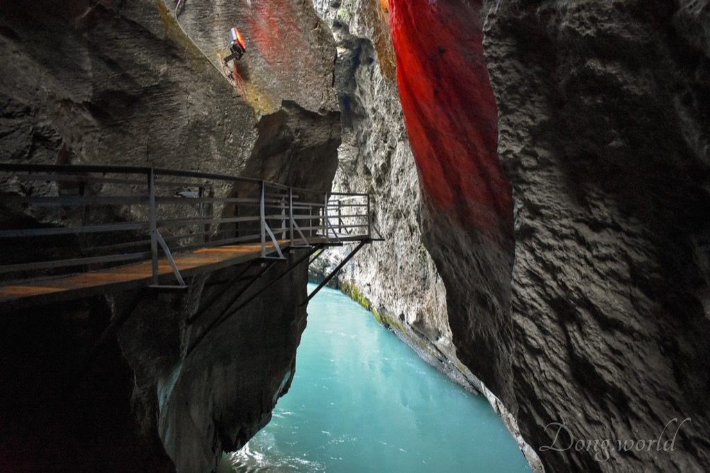
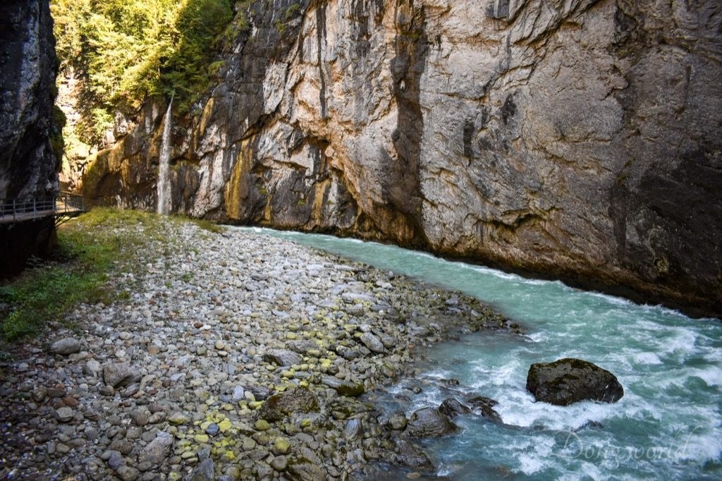
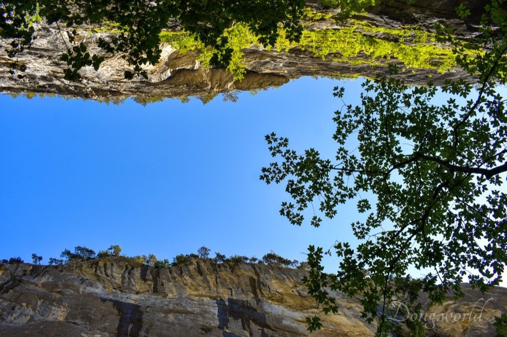
If you visit the gorge at the right moment, you will be amazed by the beauty of nature. I arrived rather early in the morning and when I was about to exit a tunnel, the sun shined in. As you can see in the 1st picture above, drops of water continuously fell from the rocks, forming a curtain made of pearls and behind it, because of temperature difference, the water evaporated in the sunlight, creating a fairyland. The lighting was so soft and gentle and it brought not only life but also peace into the unique world. It was really difficult to capture the miracle with my camera so I guess you will have to experience it by yourself.
Info point No. 9: overhanging cliff
The overhanging cliff on the other side of the info board is an impressive illustration of the power of water.
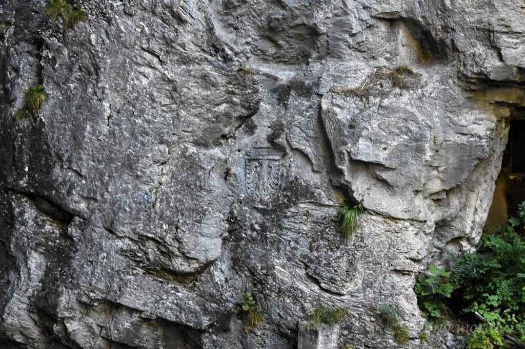
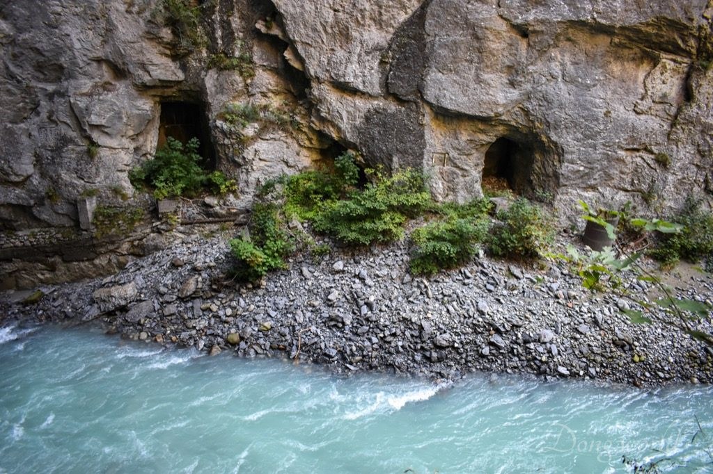
Info point No. 10: the Hasli Eagle & info point No. 11: underground cavern from WWII
On the opposite side of the info boards, you can see the Hasli Eagle carved into the cliff, which adorns the official seal, banner and flag of Haslital. The two holes to the right of the Eagle were entrances to two military caverns built at the end of 1940. The larger cavern was planned to be used as a dormitory for 185 officers and soldiers and all the technical equipments were installed in the other cavern. The offices, recreation room and dining rooms were installed in a stationary train in the tunnel. For some reason, the installations were never used and still exist in the Kirchet. One of the few visitors to the interior reported that: “The caverns were very luxurious for me: wooden walls, heating, running water, flushing toilets, electric lighting…”

Info point No. 12: “Trockene Lamm”
In 1898, 10 years after the gorge was opened to the public, the “Trockene Lamm” was made accessible by a pathway and an iron bridge (because it’s on the other side of the Aare river). 42 years later, both the pathway and bridge were removed because the maintenance cost was too high. Nowadays, parts of the old pathway can still be seen and the “Trockene Lamm” still remains largely unknown.

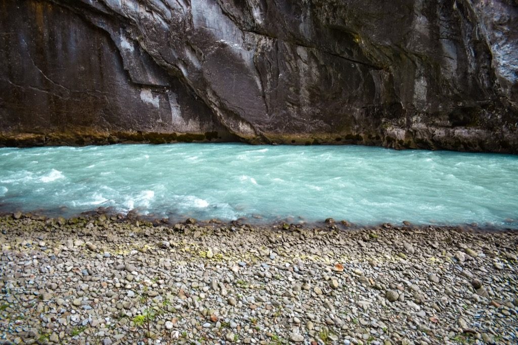
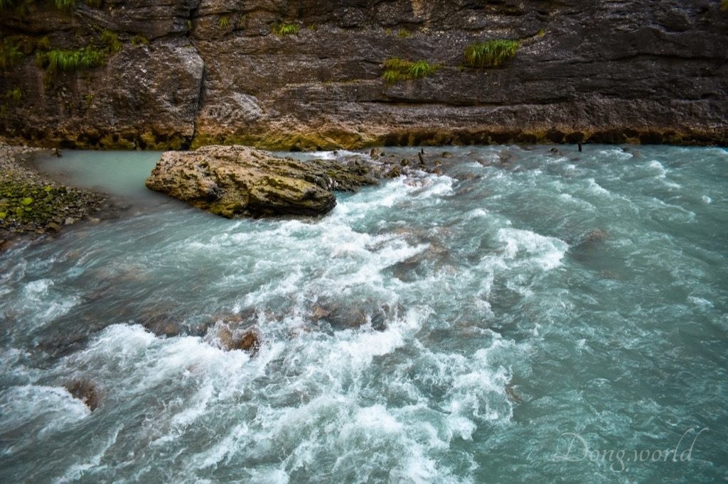
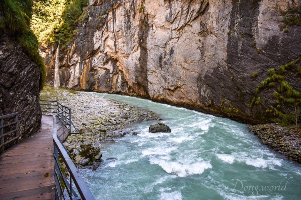
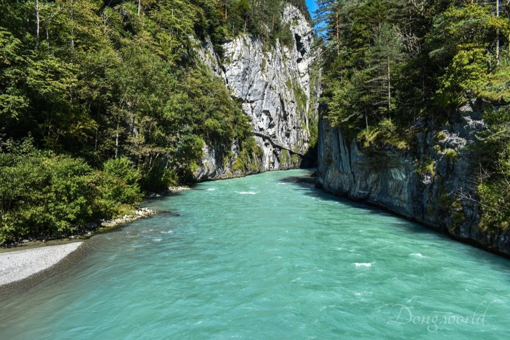
Along the way, I couldn’t help praising the Aare river because it’s simply miraculous. The water wasn’t as clear as crystal but its milky and cyan color kept enchanting me.

Info point No. 13: glacier mill
A glacier mill, or moulin, is a roughly circular, vertical to nearly vertical well-like shaft within a glacier or ice sheet which water enters from the surface. The term is derived from the French word “moulin” because of the rotating motion of the melting water. It is said on the info board that glacier mills can reach up to 20 meters in diameter and are usually formed in ice sheets and flat areas of a glacier in a region of transverse crevasses. They can reach the bottom of the glaciers which can be hundreds of meters deep and may help lubricate their base, affecting glacial motion. During the ice age, the Aare Glacier was 900 meters thick. Nowadays, evidence of the existence of the glacial mills are the potholes worn out of the limestone cliffs throughout the gorge.
Info point No. 14: Ahornifad
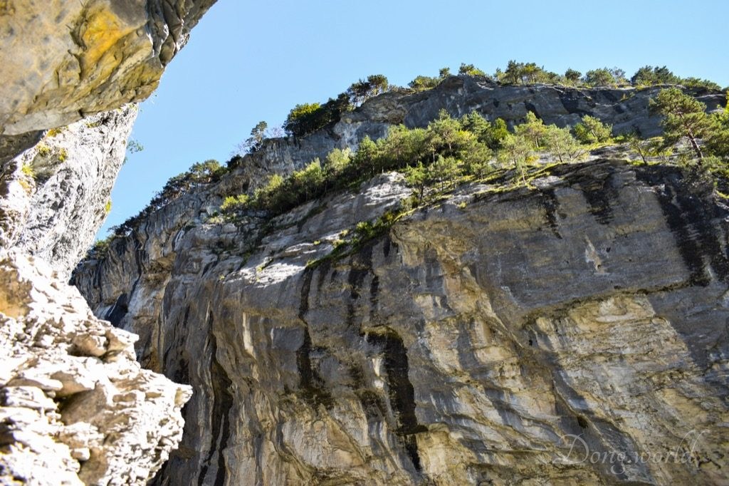
The cliff on the other side of the river is the highest in the gorge, reaching 180 meters.
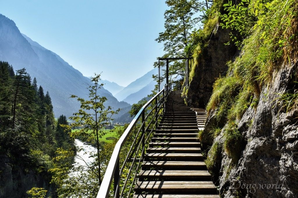
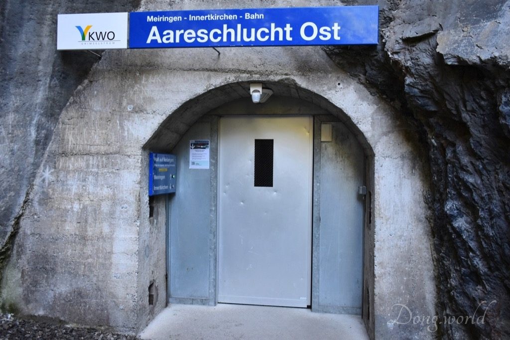
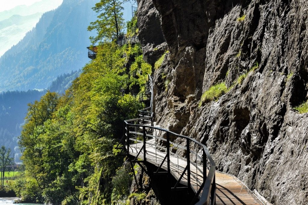
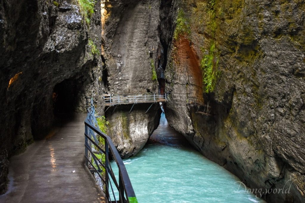
From info point No. 14 to the East Entrance you need to climb a bit, but I’m sure you won’t find it tiring because all your attention will be directed to the amazing mountains and river around you. After exiting, you can follow the signs to reach station “Aareschlucht Ost” and take the MIB train to go back, or walk back through a forest trail. If you don’t have much hiking planned for the trip, it will be an interesting experience to take the forest path, but if you want to save some energy, taking the train is convenient and much faster. By the way, the MIB ticket is included in your admission to the Aare Gorge. Before reaching the station, you need to cross a suspension bridge, from which you get a great view of how the Aare river enters the gorge. Take a look at the 3rd picture above, can you guess what this place is? Without seeing the sign above the entrance, I would probably have guessed that it’s a bunker, but the sign gave its true identity away, which is a train station. Even though I’ve been living in Switzerland for more than three years, that was the first time I saw such a unique station. Don’t forget, inside the tunnel there’s only one railway, so make sure you press the right button to request a stop and board the train going in the right direction. If you can’t tell in which direction a train is going (which was my experience), check the schedule or simply ask the driver.
This is not a big attraction where you need to spend much time, but an ideal destination for a family trip. If you are tired of the white snowy peaks of the Alps, why not coming to the gorge to see the cyan Aare river, green trees, brown rocks and golden sunlight? If you are interested in geology, it’s even better because you are going to witness the fabulous geological phenomena and learn about them in an easy-to-understand way. In addition to visiting the gorge, I recommend you including in your day trip the Reichenbach Falls, where Sir Arthur Conan Doyle’s hero, Sherlock Holmes, fights to the death with Professor Moriarty, at the end of “The Final Problem“, and of course the Sherlock Holmes Museum in Meiringen, where the living room of the detective and Dr. Watson on 221B Baker Street, London is carefully arranged according to the clues that can be found in the stories.