In fact, the first time I read about Lötschental was when I was looking for where to go to visit the UNESCO World Heritage site Swiss Alps Jungfrau-Aletsch-Bietschhorn. If you have read my previous posts about this region you probably know already that the protected area is huge, 824 km2. Before, I always travelled to the southern side of Bietschhorm (3934 m) such as to the towns of Belalp, Riederalp, Bettmeralp and Fiescheralp. This time, I decided to visit the Lötschental valley, to have a look at the other side of Bietschhorm.
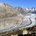
Lötschental, situated between the Bernese and Valais Alps which are inscribed in the UNESCO World Heritage list, is absolutely one of the most beautiful valleys in the canton of Valais. With its 30 km length, it is also the largest Valais side valley north of the Rhone. If I compare the valley to a ship, then the ship’s head is the Langgletscher and its two sides are the marvelous mountain peaks such as Hockenhorn (3293 m), Breithorn, Grosshorn, Mittaghorn, Sattelhorn, Schinhorn, Breitlauihorn, Bietschhorn (3934 m), Wilerhorn and so on. The ice-cold water coming from the Langgletscher glacier flows through Lötschental and meets the Rhone river south of Gampel. If you follow the river, you will not only discover the traditional villages but also experience the unspoiled nature, the peaceful, calm and relaxing mountain paradise.

It was not until I arrived at the cable car station in the valley did I realize that there are so many things to do and to see here. I strongly recommend you taking a brochure called “The Magic Valley – Information Lötschental Summer” from either the cable car station or the tourist info points because it contains basically all the necessary information for you to have a good time here. If you wanna plan your trip in advance, you can either click here to check the official website or finish reading this post and I believe you will have a clear idea of what the magic valley offers.
Before arriving here, I had already known that the Lötschental valley is the paradise for hiking lovers. In total there are more than 26 hiking routes reaching as far as Jeizinen, Goppenstein, Rinderhütte, Selden (Kandersteg), Blauseeli, Anenhütte, Bietschhornhütte and so on. Of course, the difficulty levels of various routes are also different. Some are suitable for families with children such as the “Lötschental Legend Trail”, the “Lötschental Panoramic Trail” and the “Cultural Trail” while some are only for experienced hikers, for example the “Bietschhorn Hut Trail” and the “Lötschenpass Hut Trail”. I suggest you obtain a brochure called “The Magic Valley – Hiking Recommendations” either from the cable car station or from the info points and on it you will see a map with all the routes marked with numbers and a table telling you where the start and end of each route are and how difficult it is and how long it takes to finish one specific route.
In this post, I’m gonna first of all provide you with some useful information such as the location of the tourist info points, the schedule and ticket prices of the cable car etc.. In the second chapter, I’ll introduce to you the four villages in the valley. For example, their tradition, culture, and the activities they offer. In the third chapter, I’m gonna explain to you in detail why Lötschental is called the hiking paradise and of course I’ll focus on the route I took and share with you my own experiences. Please note that I was here in the autumn of 2017 so what I will write about are mainly gonna be about the activities in the summer season in Lötschental. However, by the end of this post, I’ll remind you and show you that there’s as much to do here in winter as in summer. Now, let’s learn about some practical information before starting our journey.
1. Practical information

In order to have a smooth and more organized trip in Lötschental, I suggest you plan it in advance. There’s much information available on the official website as for how to make the most of your time here and I suggest that hiking around and visiting the villages are the main activities that you should not miss. Before, I only knew that this was a wonderful place for hiking so I just checked the hiking trails but later, after I read the brochures I realized that there were so many other things to do in this valley. For example, the villages’ tours, the museum, the mountain tours, guided walks and many more activities for families with children. Anyway, much different from what I expected, it’s impossible to finish exploring the whole valley in a few days.
1.1 Contact
You can either contact the Lötschental Tourism Office online or in person. By clicking here you will not only see the contact details such as phone number and email address but also the opening hours of the info points in Wiler and Lauchernalp. Personally, I suggest you contact them by email or phone because they reply fast and you don’t need to worry about whether the info points are open or not. Of course if you prefer you can also visit them in person but please check their opening hours before going. What I’d like to remind you of is that the info points are also open in winter. When I visited the “Tourist Office” page on the official website, it seemed that they were open only till the end of October, but I checked the information brochure for winter activities in Lötschental and I found that they were also open in winter. Probably when you visit the page it will be updated already. If not, please write me and I’ll send you a picture of the winter opening hours of the info points.
1.2 How to get there
Though lying among the high mountains, Lötschental is easily accessible by public transport from either Bern or Brig. You just need to take a train from them to a village called Goppenstein and from there the Post Bus 591 will take you to go through the valley. Of course there are in-between stops along the way and once you are close to the starting point of your journey, all you need to do is to press the “stop” button to get off.
1.3 Wiler – Lauchernalp cable car
Lauchernalp is the starting point of many hiking trails and mountain tours on the northern “wall” of the valley (most of the popular hiking trails are on this side) and the cable car provides easy access to it. If you want to save some energy or time (1 h 15 mins) for some hiking experiences at a higher altitude (~1968 m), I suggest you take the cable car.
- If you want know about the schedule of the cable car in summer season please click here.
- If you want know about the ticket prices of the cable car in summer season please click here.
- If you want know about the schedule of the cable car in winter season please click here.
- If you want know about the ticket prices of the cable car in winter season please click here.
Please note that the cables cars are also in operation in autumn but they go less frequent than in the summer or winter season. I suggest you check carefully on which day and at what time they operate to avoid inconveniences.
2. The four villages

What I regret now the most is that I didn’t explore the four villages in the valley. I’m always interested in the Swiss villages in the aspect of their culture, history and traditions but this time, I was so attracted to the surrounding hiking routes that I even neglected them. If you like the culture, history and traditions of the alpine villages as much as nature, don’t make the same mistake as I did.
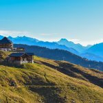
The four mains villages in this valley are Ferden, Kippel, Wiler and Blatten. Ferden is the first village that you will encounter when you go through Lötschental. Being the gateway to this valley, it is also the second largest village here with an old village center consisting of buildings from the 14th and 15th century. If you are interested in architecture, these buildings testify to the architectural style and construction methods in this region of that period of time. The second village, Kippel, is popular among the visitors because of the ornamental timber façades and St. Martin’s Church, which dates back to the 16th century. The Lötschental museum is also located here and if you are interested in history you will be amazed in the world of alpine traditions and customs. At the heart of the Lötschental valley lies the third village Wiler, where the “Gsteinät” Recreation Park is located , providing various facilities for both the old and the young to play football, volleyball, table tennis, basketball and mini golf. It is also here that the lower terminal station of the cable car shuttling between the valley and Lauchernalp (1970 m) is located. As I mentioned before, Lauchernalp is the starting point for many hiking routes and mountain tours. The forth village, also the highest one of the four is featured by its typical Valais granaries, unspoiled nature and timber houses, blackened by the sun and covered by stone slates.
If you speak or at least understand German then congratulations because you will be able to use the “Lötschental App” to enjoy the audio tours on your smartphone or on an iPod that you can borrow free of charge at a number of lending venues. By listening to the audio explanations, you will become your own village guide and enjoy interesting insights into the history of Lötschental on a signposted route through the villages. These are not just anonymous people speaking on the tour, but people from the Lötschental valley telling their stories. For more information such as how to download the app on your smartphone, how to use it and where and how to rent the iPods please click here.
If you don’t understand German at all then I’m afraid you will have to contact the Tourism Office to reserve a special guided village tour in English.
Anyway, there are a lot of things to do in or around the villages. For example, you can:
- visit the Lötschental Museum (more than 60 wooden masks demonstrate the history of masking in Lötschental since 1900. You will also see traditional costumes and the historic uniforms of the “Grenadiers of God”)
- join the celebration of local holidays and witness local traditions (for example, Tschäggättä and Grenadiers of God)
- join the “Alpine Tours” (mountaineering for beginners, trained hikers and advanced hikers)
- join the “Guided Walks” (for example “Glacier Forefield” or “Flower Power”)
- have fun in the climbing park (with 5 different sectors and over 40 routes with difficulty levels ranging from 3-7. no previous knowledge required and equipments can be rented)
- have fun at the Lauchernalp Climbing Wall (behind the Berghaus Lauchernalp)
- do mountain biking
- explore, discover and enjoy nature (for example the Riedhaltä Bird Sanctuary and fishing)
- ride on a monster scooter
- and of course do HIKING!
Please click on the links attached to particular activities that you are interested in for more information such as the opening hours, prices, location, contact details and so on. Please also note that the activities I mentioned above are mostly for summer and if you are interested in the activities in winter please click here. If you still have questions please don’t hesitate to contact me or contact the Lötschental Tourism Office directly by phone: +41 (0)27 938 88 88 or by email: info@loetschental.ch. Now let’s take a close look at why Lötschental is called the hiking paradise.
3. The hiking paradise


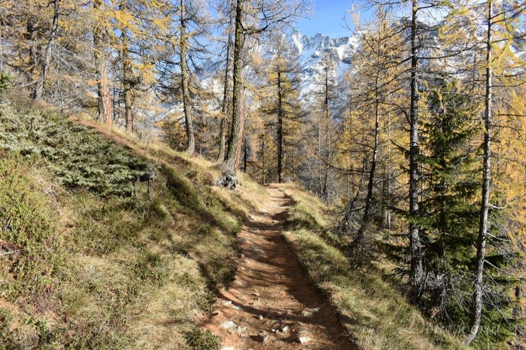
The pictures shown above were taken while I was hiking from Lauchernalp to Fafleralp. Originally I was planning to take half of the “Panoramic Trail” (the whole trail goes from Faldumalp to Fafleralp and it takes around 5 hours to finish) but by accident this half trail overlaps with the “Legend Trail” so I guess it counts as I took the “Legend Trail” as well. In this chapter I’ll first of all introduce to you some “tools” to plan or to do your hiking more conveniently. Then I’ll recommend you some highlighted hiking routes and last but not least, I’ll tell you about my own hiking experience.
3.1 How to get ready
Before arriving in Lötschental, you should have in mind what kind of hiking trail you prefer, how long (both in distance and in time) you wanna hike and how experienced you are in hiking (for example, how well you can manage the trails of different difficulty levels). Then you can click here to check the main categories of the hiking trails such as Ordinary Hiking Trails, Themed Trails, Pilgrim Trails, Mountain Tours, Alpine Tours and so on. After you choose a specific category you will see all the relevant trails. Click on the trail that you are interested in and you will see the route on a map, a detailed explanation including turn-by-turn directions, how to getting there, the protected areas etc. as well as some practical information such as the difficulty level, the total distance, the duration of time, the ascent and descent and mostly importantly, whether it is open or not. After you choose your preferred trail, you can already start packing your hiking clothes and equipments. Depending on your preference, you can guide yourself using the interactive hiking map or the Lötschental App on your smart phone, the brochure called “Hiking Recommendations” which contains a small map (free and can be obtained at the cable car stations, info points ect.) or the “Hiking Map Lötschental” which can be bought at the Tourism Office or online. Now I believe you are officially ready for your adventure in the hiking paradise.
3.2 Hiking highlights


According to the brochures called “The Magic Valley – Information Lötschental Summer” and “The Magic Valley – Hiking Recommendations”, the Lötschental Legend Trail, Lötschental Panoramic Trail, Themed Trail & Nature Path, Bietschhorn Hut Trail, Lötschenpass Trail and the Cultural Trail are highly recommended and are the most popular. I personally took half of the Panoramic Trail which happened to be the Legend Trail at the same time and I’ll introduce it to you in detail in the next section. As for the other trails, I’ll give you a brief introduction based on the information I read from the brochures I mentioned above.
3.2.1 The Bietschhorn Hut Trail
This trail can be started from Blatten (3 h 5 mins), Ried (3 h 10 mins) or Wiler (3 h 35 mins). At the hut you can enjoy outstanding views over the Lötschental valley and see clearly the Hockenhorn ridge. The Bietschhorn Hut is open from mid-July to the 31th August and on weekends on request from late June to mid-July and in September. Pleas note that this hiking trail is marked as difficult and the ascent can be more than 1000 meters. If you are an experienced hiker, the Bietschhorn Hut is also the starting point for Bietschhorn- and Wilerhorn-ascents and other alpine hikes. For more information please click here.
3.3.2 The Themed Trail & Nature Path


Landscapes do not stay the same forever – they are created and change over the course of time with the effects of Mother Nature and Man. Along a total of 23 stations, the Theme Trail tells in pictures the history of the formation of this impressive mountain landscape in the forefield of the “Langgletscher“.
I saw the starting point of this trail (easily accessible by Post Bus 591 because it’s its end station) when I finished my hiking and it was already dark, so I couldn’t continue my journey. In fact I think this hiking trail matches better with my goal of exploring this valley because this area is protected by the UNESCO. Before starting, you will see a map marked with the route and the 23 info stations. Depending on how much time you have and how far you are able or are willing to go, you can choose from three different routes which cover all the stations 1-23 (13 km, 4 h 45 mins), stations 1-14 and 19-23 (10.4 km, 3.5 h) and stations 1-14 only (8.4 km, 2 h 45 mins). I already marked and included this trail in my future hiking plan. For more information about this trail, please click here.
3.3.3 The Lötschenpass Trail
Please note that this trail is marked as difficult (distance: 11.2 km, duration: 5 h 40 mins, ascent: 1275 m, descent: 823 m) and if you plan to take it, you’d better wear professional clothes and shoes and prepare all the necessary equipments. The climbing up starts from Lauchernalp, where you can get by hiking up or talking a cable car from Wiler, and finishes at Lötschenpass Hut (2690 m). From there, the magnificent view over the pass, the valley and towards the Bietschhorn and the Mischabel Range is your reward for climbing for 3.5 hours. Afterwards, the more than 2 hours’ steep descent from Lötschenpass Hut to Selden (Kandersteg) includes crossing the Lötschen Glacier, but don’t worry, this can be managed with hiking boots. Again, I’d like to remind you that on this hiking trail, some paths might not be visible and there are exposed sections secured with ropes or chains. You need to make some preparation before deciding to take it. For more information please click here.
3.3.4 The Cultural Trail
The Cultural Trail (difficulty level: easy, distance: 9.1 km, duration: 3 h, ascent: 550 m, descent: 240 m) takes hikers to walk on the shady side of the valley from Goppenstein to Blatten, along the Lonza mountain stream. On this side, hikers will have a great view over the villages and there’s an opportunity to leave the trail at each village (Ferden, Kippel, Wiler and Blatten). For more information please click here.
Of course, with 200 km of marked hiking trails, there are many other options. You can also combine them and sometimes make a small detour. All I wanna say is that there are endless possibilities as long as you love nature and have the spirit of exploring and discovering. Now follow me and take a look at the two hiking trails that I’ve taken.
3.3 The Lötschental Panoramic Trail, Legend Trail and my own experiences


3.3.1 The Lötschental Panoramic Trail and Legend Trail
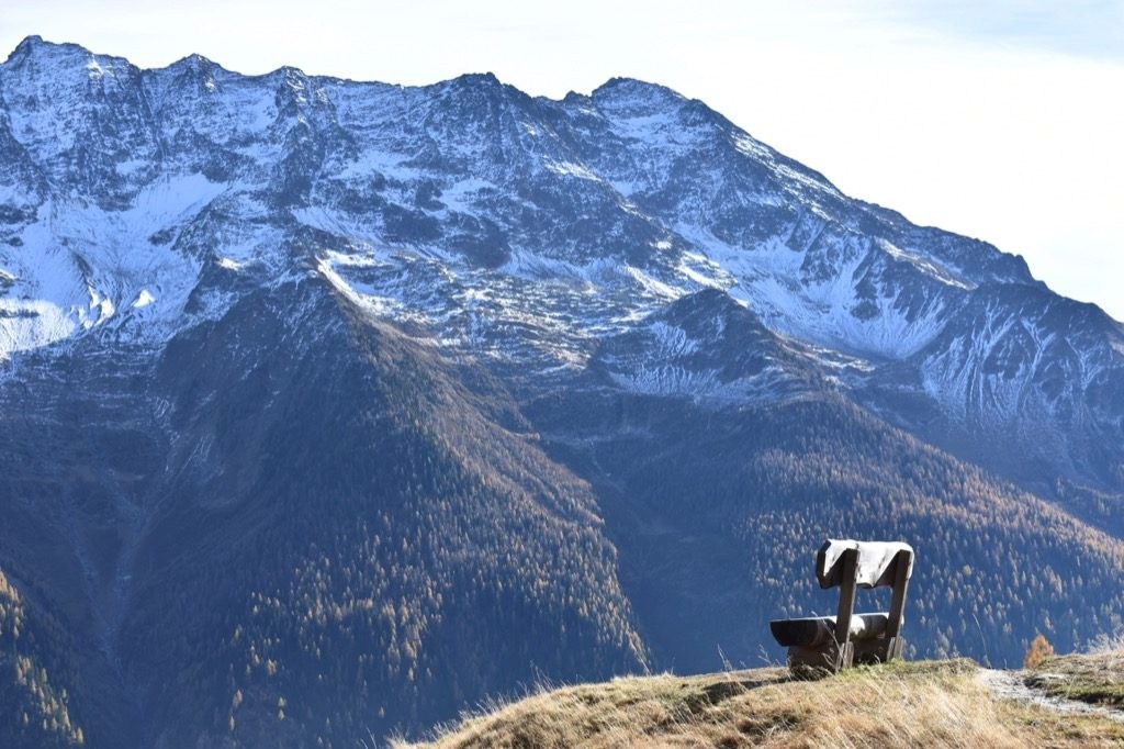
The Lötschental Panoramic Trail is one of the best-known panoramic trails in Valais and I believe that once you finish looking at the pictures above you will understand why. Situated entirely between the altitude of 1800 and 2100 meters, this route offers hikers a marvelous view over the valley and towards the Bernese Alps such as the Wilerhorn, Bietschhorn, Breithorn and so on. In fact, the entire trail should be from Faldumalp to Fafleralp and it takes around 5 hours to finish. I took only half of it and hiked from Lauchernalp to Fafleralp and the duration was around 2.5 hours. It was not long after I started my hiking that I noticed a trunk with a sign saying “Lötschental SAGEBWEG”. I checked again on the hiking map and realized that the Legend Trail actually overlaps with this section of the Panoramic Trail that I chose. It was nice to hit two birds with one stone.

The Lötschental Legend Trail (difficulty level: easy, distance: 9 km, duration: 2 h 45 mins, ascent: 360 m, descent: 565 m) is ideal for families with children or anyone who is interested in mysteries. Ten different legends on the tree trunks take hikers into a world of myths and fairytales. If you don’t really understand German, you can scan the QR codes with your smartphone to read the legends in English or French. For example, at station 8, the legend is about “The Angels’ Mass on the Balmenstein”. To know more about the Legend Trail please click here.
Now let’s come back to the Panoramic Trail. If you only wanna take half of it like I did, then the statistics are the same to the ones of the Legend Trail. However, if you wanna take the whole route (difficulty level: easy, distance: 16.8 km, duration: 4 h 50 mins, ascent: 950 m, descent: 700 m), it connects Faldumalp and Fafleralp and takes 5 hours to finish. For more information about it, please click here.
3.3.2 My own experience
Personally, what impressed me the most are the alpine villages, the wild, romantic forests, the alpine meadows and the Schwarzsee (the black lake).


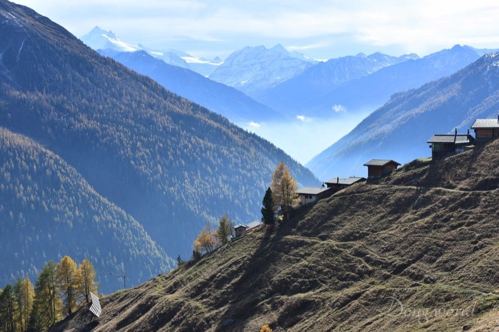
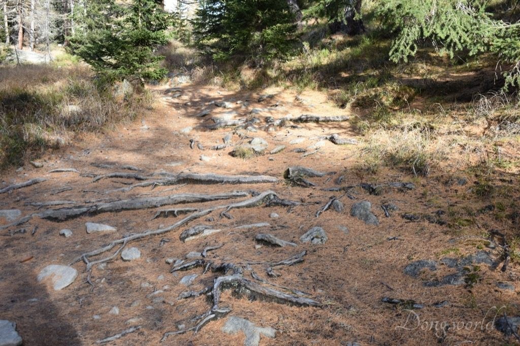

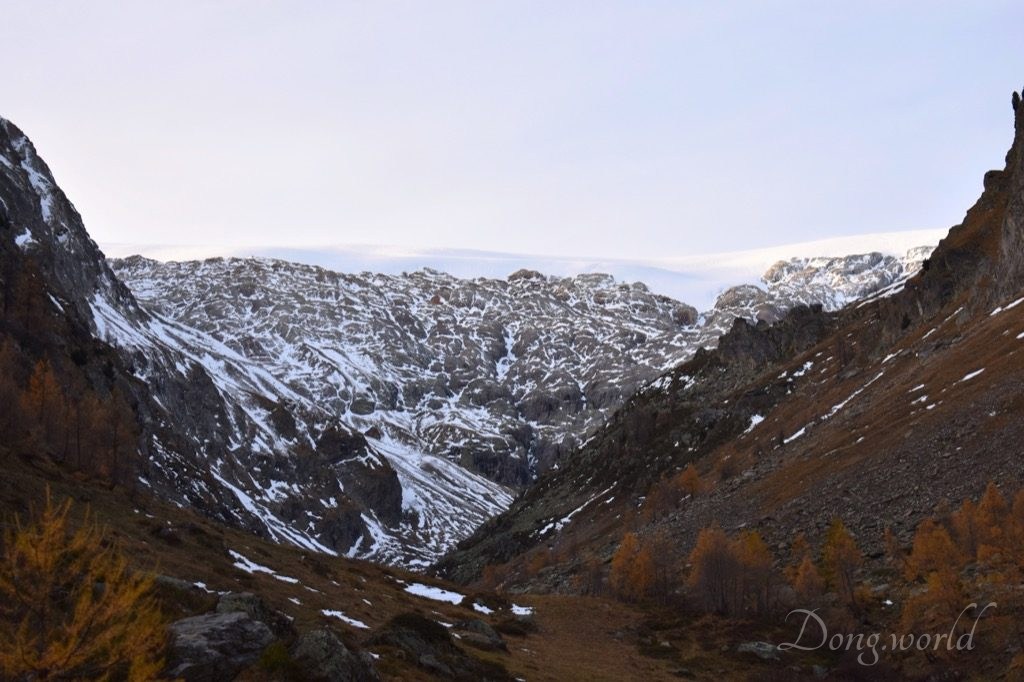

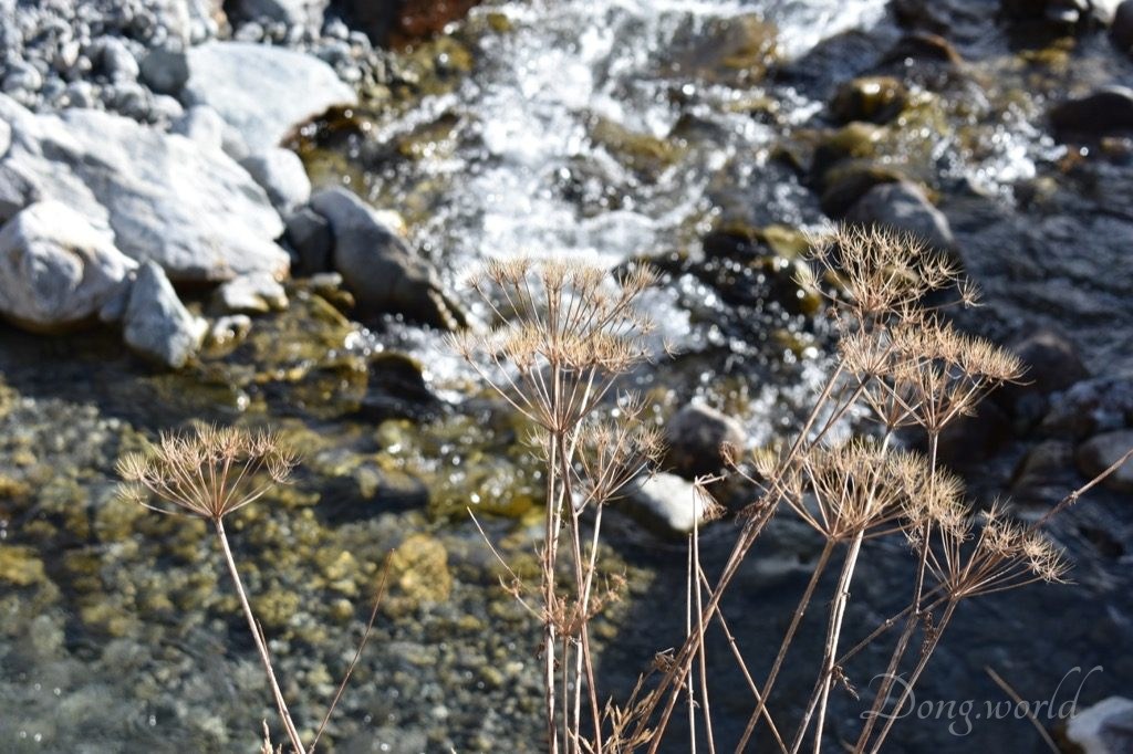
On my way I passed some small villages such as Weritzalp and Tellialp and I saw so many sheep with bells (I thought only cows wear bells in the Alps) wandering around, so many chalets, so many snowy mountain peaks, so many larches and pines. The route in general was easy to walk on and all you need to do is to follow the yellow marks (as shown in the third picture in this section) and the signposts. Please remember to take some water with you because there’s basically no fountain on this path (the only one is close to Tellialp) and I got really thirsty on the way. That’s when I noticed the red berries in the forests. At the beginning I wasn’t sure whether they were edible or not but as I went further, I saw some people picking them and collecting them in jars. I asked them why they picked these berries and they said that they were used for making marmalade. I picked one from the the ground and opened it but I was really disappointed to see that it’s like dried fruit… no juice at all… Anyway, I kept walking and the sun went lower and lower. It got a bit adventurous while I was going through the wild forests and across the alpine meadows because the sky was getting dark and I could always hear some creatures bellowing. My friend told me that they were probably dogs or ducks but for me the bellowing was very special (unlike the one of dogs or ducks). All of a sudden, I saw two animals running up the slope of the mountain across the Schwarzsee but before I could get the attention of my friend they already disappeared. I couldn’t figure out what kind of animals they were but judging from the size and distance between them and me, they were definitely much bigger than dogs or ducks. Except this exciting and a bit thrilling experience, all I could feel during my hiking was tranquility, especially when the sun went down and there was no more bright light in the valley. At that moment, everything seemed to have calmed down and nothing could stop mother nature from going to sleep. While walking in Fafleralp towards the bus stop, I felt in particular how small and trivial I was. Ahead of me was the Langgletscher Glacier and around me were the more-than-3000-meter-high mountains. They were the masterpieces of nature while I was simply an admirer.
Indeed, Lötschental valley is the hiking paradise. For my next trip here, I’ll take the Themed Trail & Nature Path, starting from where I stopped this time and going further to the Langgletscher Glacier. Whether in summer or winter, in autumn or spring, let’s discover and experience the magic of this valley together!